Approximate Location Map
Large Map »
Latitude: 51.0768 / 51°4'36"N
Longitude: 0.6619 / 0°39'42"E
OS Eastings: 586566
OS Northings: 134198
OS Grid: TQ865341
Mapcode National: GBR QW2.D5N
Mapcode Global: FRA D688.PPD
Plus Code: 9F323MG6+PQ
Entry Name: Goods Hill House
Listing Date: 8 May 1950
Grade: II
Source: Historic England
Source ID: 1362824
English Heritage Legacy ID: 179787
ID on this website: 101362824
Location: Parkgate, Ashford, Kent, TN30
County: Kent
District: Ashford
Civil Parish: Tenterden
Traditional County: Kent
Lieutenancy Area (Ceremonial County): Kent
Tagged with: House
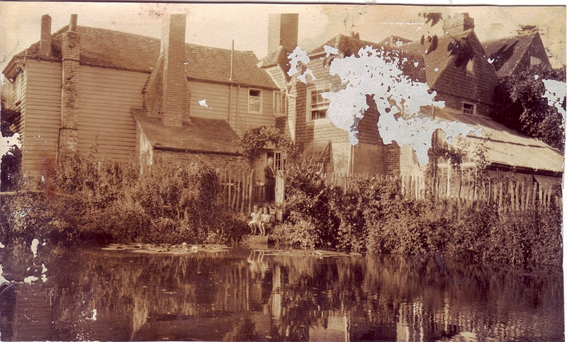
1.
1715 PARKGATE ROAD
(South West Side)
Goods Hill House
TQ 83 SE 3/112 8.5.50.
II
2.
On the map called Hoskins Farm.
An L-shaped C18 house. 2 storeys. Ground floor red brick, above tile-hung.
Tiled roof with bracket eaves cornice. 2 sashes with glazing bars intact.
Doorcase with pilasters, open pediment and semi-circular fanlight.
Listing NGR: TQ8700233688
External links are from the relevant listing authority and, where applicable, Wikidata. Wikidata IDs may be related buildings as well as this specific building. If you want to add or update a link, you will need to do so by editing the Wikidata entry.


Other nearby listed buildings
