Approximate Location Map
Large Map »
Latitude: 51.0409 / 51°2'27"N
Longitude: 0.741 / 0°44'27"E
OS Eastings: 592251
OS Northings: 130415
OS Grid: TQ922304
Mapcode National: GBR RXW.N4W
Mapcode Global: FRA D6FC.JHZ
Plus Code: 9F322PRR+99
Entry Name: Old Barrack Farm
Listing Date: 8 June 1972
Grade: II
Source: Historic England
Source ID: 1203412
English Heritage Legacy ID: 179798
ID on this website: 101203412
Location: Reading Street, Ashford, Kent, TN30
County: Kent
District: Ashford
Civil Parish: Tenterden
Traditional County: Kent
Lieutenancy Area (Ceremonial County): Kent
Tagged with: Agricultural structure
1.
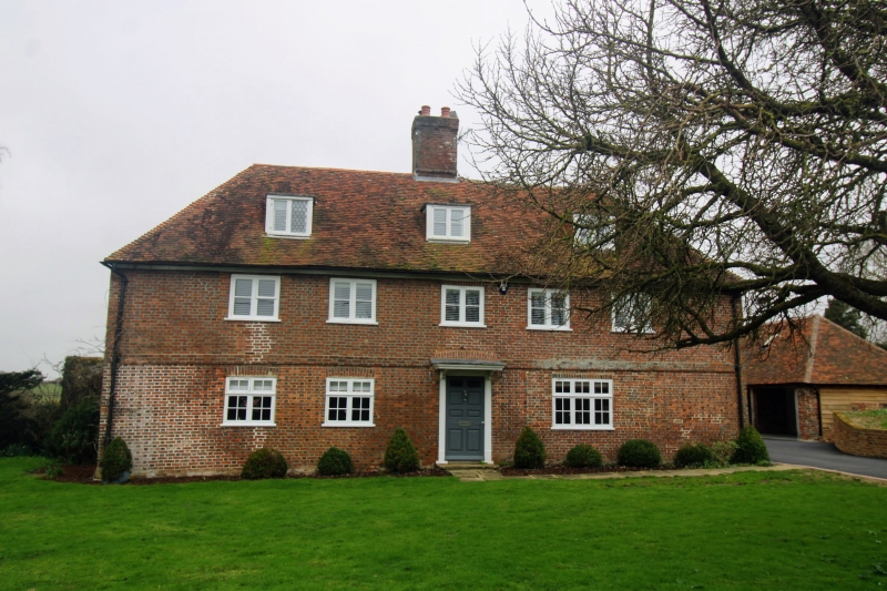
1715 READING STREET
(South West Side)
Old Barrack Farm
TQ 93 SW 6/153
II GV
2.
Formerly the Post Office, Reading Street. Dated 1724 on the frame of
the centre 1st floor window. 2 storeys and attic. Red brick with grey
headers. Hipped tiled roof with central stack. 3 dormers. Stringcourse.
5 casement windows. Doorcase with flat wooden weatherhood.
Ebony Cottage, Wellbro Cottage, Skeers House & Old Barrack Farm form a group.
Listing NGR: TQ9131731227
External links are from the relevant listing authority and, where applicable, Wikidata. Wikidata IDs may be related buildings as well as this specific building. If you want to add or update a link, you will need to do so by editing the Wikidata entry.


Other nearby listed buildings
