Approximate Location Map
Large Map »
Latitude: 51.0647 / 51°3'53"N
Longitude: 0.6825 / 0°40'57"E
OS Eastings: 588056
OS Northings: 132911
OS Grid: TQ880329
Mapcode National: GBR QW8.5CY
Mapcode Global: FRA D699.RQ6
Plus Code: 9F323M7M+V2
Entry Name: The Cedars
Listing Date: 8 May 1950
Grade: II*
Source: Historic England
Source ID: 1071121
English Heritage Legacy ID: 179823
ID on this website: 101071121
Location: Tenterden, Ashford, Kent, TN30
County: Kent
District: Ashford
Civil Parish: Tenterden
Built-Up Area: Tenterden
Traditional County: Kent
Lieutenancy Area (Ceremonial County): Kent
Tagged with: Building
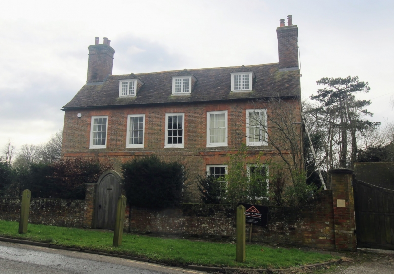
1.
1715 SMALLHYTHE ROAD
(West Side)
The Cedars
TQ 83 SE 3/71 8.5.50.
II*
2.
C18. 2 storeys and basement red brick. Hipped roof with modillion eaves
cornice. 5 sashes with glazing bars intact. Porch up 7 steps with 2
reeded pilasters and 2 Roman Composite columns. Blocked semi-circular
fanlight. 2 wrought iron railings. Curved bay of 3 windows on both floors
on the south front with castellated parapet over.
Listing NGR: TQ8805632911
External links are from the relevant listing authority and, where applicable, Wikidata. Wikidata IDs may be related buildings as well as this specific building. If you want to add or update a link, you will need to do so by editing the Wikidata entry.


Other nearby listed buildings
