Approximate Location Map
Large Map »
Latitude: 51.0678 / 51°4'4"N
Longitude: 0.6854 / 0°41'7"E
OS Eastings: 588243
OS Northings: 133258
OS Grid: TQ882332
Mapcode National: GBR QW3.S51
Mapcode Global: FRA D6B9.DT7
Plus Code: 9F323M9P+44
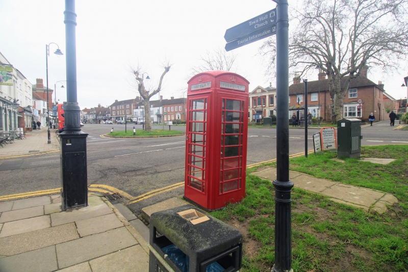
Entry Name: K6 Telephone Kiosk
Listing Date: 17 February 1989
Grade: II
Source: Historic England
Source ID: 1071133
English Heritage Legacy ID: 179853
ID on this website: 101071133
Location: Tenterden, Ashford, Kent, TN30
County: Kent
District: Ashford
Civil Parish: Tenterden
Built-Up Area: Tenterden
Traditional County: Kent
Lieutenancy Area (Ceremonial County): Kent
Tagged with: K6 telephone box
This list entry was subject to a Minor Amendment on 20/03/2014
TQ 8833-8933
1/225
TENTERDEN
STATION ROAD/JUNCTION WITH HIGH STREET
K6 Telephone Kiosk
GV
II
Telephone kiosk. Type K6. Designed 1935 by Sir Giles Gilbert Scott. Made by
various contractors. Cast iron. Square kiosk with domed roof. Unperforated
crowns to top panels and margin glazing to windows and door.
Listing NGR: TQ8824333258
External links are from the relevant listing authority and, where applicable, Wikidata. Wikidata IDs may be related buildings as well as this specific building. If you want to add or update a link, you will need to do so by editing the Wikidata entry.


Other nearby listed buildings
