Approximate Location Map
Large Map »
Latitude: 51.0293 / 51°1'45"N
Longitude: 0.7896 / 0°47'22"E
OS Eastings: 595707
OS Northings: 129250
OS Grid: TQ957292
Mapcode National: GBR RY4.GF6
Mapcode Global: FRA D6JD.KF8
Plus Code: 9F322QHQ+PR
Entry Name: Queens Arms
Listing Date: 9 August 1979
Grade: II
Source: Historic England
Source ID: 1071025
English Heritage Legacy ID: 180083
ID on this website: 101071025
Location: Appledore, Ashford, Kent, TN26
County: Kent
District: Ashford
Civil Parish: Appledore
Built-Up Area: Appledore
Traditional County: Kent
Lieutenancy Area (Ceremonial County): Kent
Tagged with: Building
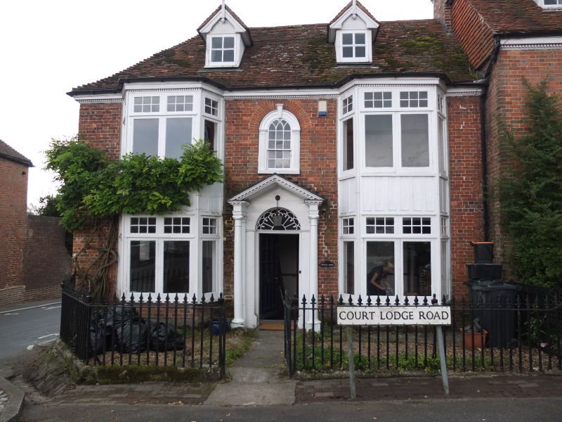
APPLEDORE COURT LODGE ROAD
1.
5272
(south side)
No 2 (Queens Arms)
TQ 9529 15/1
II GV
2.
C18. Two storeys and attics. Red brick. Tiled roof and dentilled wooden eaves
cornice. Two gabled dormers. Two modern bays on both floors. Round-headed
window in the centre of the 1st floor. Porch with a pediment containing a round-headed
doorway with semi-circular tympanum.
Listing NGR: TQ9570429252
External links are from the relevant listing authority and, where applicable, Wikidata. Wikidata IDs may be related buildings as well as this specific building. If you want to add or update a link, you will need to do so by editing the Wikidata entry.


Other nearby listed buildings
