Approximate Location Map
Large Map »
Latitude: 51.1164 / 51°6'58"N
Longitude: 0.6444 / 0°38'39"E
OS Eastings: 585176
OS Northings: 138558
OS Grid: TQ851385
Mapcode National: GBR QVG.V0X
Mapcode Global: VHJN8.460J
Plus Code: 9F324J8V+HP
Entry Name: Townland Farmhouse
Listing Date: 16 August 1962
Grade: II
Source: Historic England
Source ID: 1185110
English Heritage Legacy ID: 180174
ID on this website: 101185110
Location: Biddenden, Ashford, Kent, TN27
County: Kent
District: Ashford
Civil Parish: Biddenden
Built-Up Area: Biddenden
Traditional County: Kent
Lieutenancy Area (Ceremonial County): Kent
Tagged with: Farmhouse
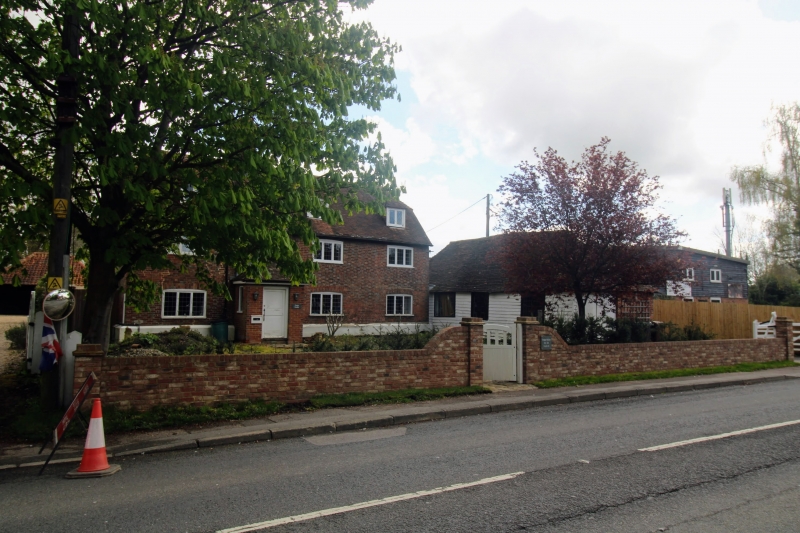
BIDDENDEN NORTH STEEET
1.
5272 (east side)
To 32 (Townland Farmhouse)
TQ 5558 16/70 16.8.62.
II
2.
A timber-framed building, Cl7 or earlier, refronted in the C18 with weatherboarding, the sides tile hung. Two storeys. Half-hipped tiled
roof. Wooden eaves cornice with brackets.
Listing NGR: TQ8517638558
External links are from the relevant listing authority and, where applicable, Wikidata. Wikidata IDs may be related buildings as well as this specific building. If you want to add or update a link, you will need to do so by editing the Wikidata entry.


Other nearby listed buildings
