Approximate Location Map
Large Map »
Latitude: 51.0514 / 51°3'4"N
Longitude: 0.6303 / 0°37'49"E
OS Eastings: 584453
OS Northings: 131295
OS Grid: TQ844312
Mapcode National: GBR QWD.45K
Mapcode Global: FRA D66B.PDL
Plus Code: 9F323J2J+H4
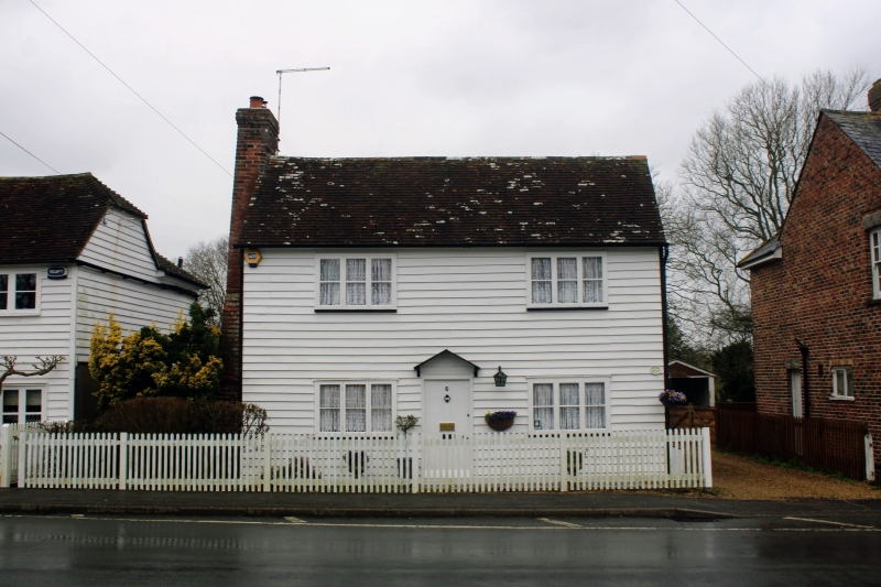
Entry Name: 6, High Street
Listing Date: 9 August 1979
Grade: II
Source: Historic England
Source ID: 1070917
English Heritage Legacy ID: 180331
ID on this website: 101070917
Location: Rolvenden, Ashford, Kent, TN17
County: Kent
District: Ashford
Civil Parish: Rolvenden
Built-Up Area: Rolvenden
Traditional County: Kent
Lieutenancy Area (Ceremonial County): Kent
Tagged with: Building
ROLVENDEN HIGH STREET
1.
5272
(west side)
No 6
TQ 8431 18/287
II GV
2.
C18. Two storeys weatherboarded. Tiled roof. External brick chimneystack.
Two casement windows. Pediment-shaped weather hood.
Listing NGR: TQ8445331295
External links are from the relevant listing authority and, where applicable, Wikidata. Wikidata IDs may be related buildings as well as this specific building. If you want to add or update a link, you will need to do so by editing the Wikidata entry.


Other nearby listed buildings
