Approximate Location Map
Large Map »
Latitude: 51.0515 / 51°3'5"N
Longitude: 0.6302 / 0°37'48"E
OS Eastings: 584444
OS Northings: 131306
OS Grid: TQ844313
Mapcode National: GBR QWD.44F
Mapcode Global: FRA D66B.PBC
Plus Code: 9F323J2J+H3
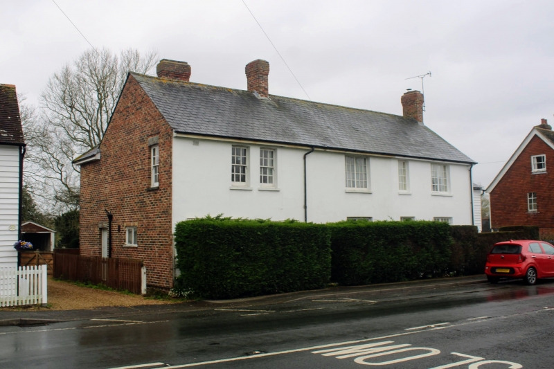
Entry Name: 8, High Street
Listing Date: 9 August 1979
Grade: II
Source: Historic England
Source ID: 1115722
English Heritage Legacy ID: 180332
ID on this website: 101115722
Location: Rolvenden, Ashford, Kent, TN17
County: Kent
District: Ashford
Civil Parish: Rolvenden
Built-Up Area: Rolvenden
Traditional County: Kent
Lieutenancy Area (Ceremonial County): Kent
Tagged with: Building
ROLVENDEN HIGH STREET
1.
5272
(west side)
No 8
TQ 8431 18/288
II GV
2.
Early to mid C19. Two storeys red brick, stuccoed on front elevation. Slate
roof. Five windows, some sashes some casements. Simple doorcase.
Listing NGR: TQ8444431306
External links are from the relevant listing authority and, where applicable, Wikidata. Wikidata IDs may be related buildings as well as this specific building. If you want to add or update a link, you will need to do so by editing the Wikidata entry.


Other nearby listed buildings
