Approximate Location Map
Large Map »
Latitude: 51.0533 / 51°3'11"N
Longitude: 0.6294 / 0°37'45"E
OS Eastings: 584383
OS Northings: 131501
OS Grid: TQ843315
Mapcode National: GBR QW6.XLR
Mapcode Global: FRA D66B.H1W
Plus Code: 9F323J3H+8Q
Entry Name: 60 and 62, High Street
Listing Date: 16 August 1962
Last Amended: 9 August 1979
Grade: II
Source: Historic England
Source ID: 1362905
English Heritage Legacy ID: 180342
ID on this website: 101362905
Location: Rolvenden, Ashford, Kent, TN17
County: Kent
District: Ashford
Civil Parish: Rolvenden
Built-Up Area: Rolvenden
Traditional County: Kent
Lieutenancy Area (Ceremonial County): Kent
Tagged with: Building
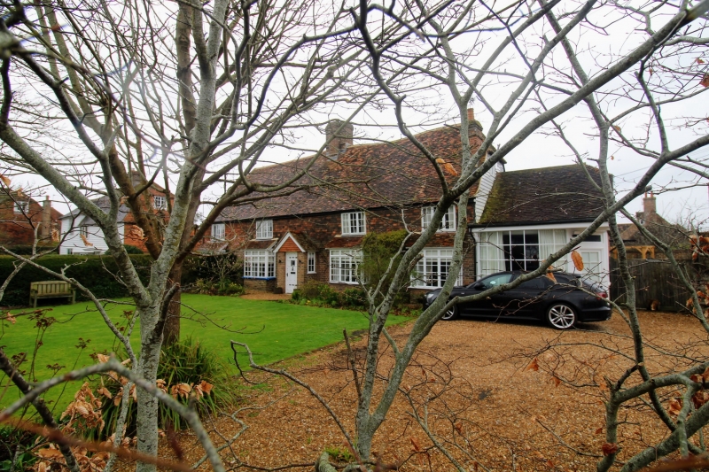
ROLVENDEN HIGH STREET
1.
5272 (west side)
Nos 60 and 62
(formerly listed as No 60)
TQ 8431 18/298 16.8.62.
II GV
2.
Probable C17 building refaced with red brick on the ground floor and tile
hung above. Half-hipped tiled roof. Two storeys. Three casement windows.
Three modern bays on the ground floor and modern porch. Later addition to
south of one bay.
Listing NGR: TQ8438131502
External links are from the relevant listing authority and, where applicable, Wikidata. Wikidata IDs may be related buildings as well as this specific building. If you want to add or update a link, you will need to do so by editing the Wikidata entry.


Other nearby listed buildings
