Approximate Location Map
Large Map »
Latitude: 51.0412 / 51°2'28"N
Longitude: 0.6424 / 0°38'32"E
OS Eastings: 585342
OS Northings: 130190
OS Grid: TQ853301
Mapcode National: GBR QWF.M82
Mapcode Global: FRA D67C.G3S
Plus Code: 9F322JRR+FX
Entry Name: 13 and 15, Maytham Road
Listing Date: 16 August 1962
Grade: II
Source: Historic England
Source ID: 1362932
English Heritage Legacy ID: 180370
ID on this website: 101362932
Location: Rolvenden Layne, Ashford, Kent, TN17
County: Kent
District: Ashford
Civil Parish: Rolvenden
Built-Up Area: Rolvenden Layne
Traditional County: Kent
Lieutenancy Area (Ceremonial County): Kent
Tagged with: Building
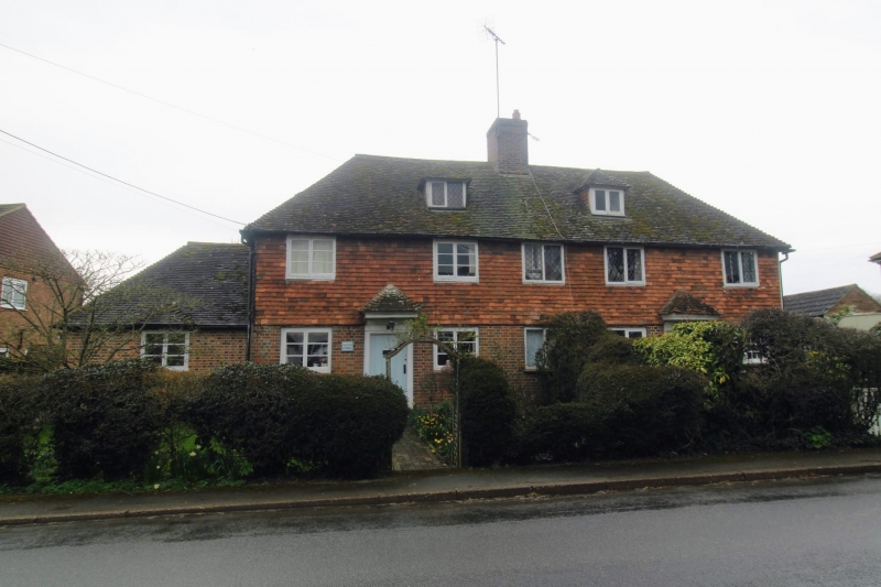
ROLVENDEN MAYTHAM ROAD
1.
5272 (south-east side)
Rolvenden Layne
Nos 13 and 15
TQ 8530 20/325 16.8.62.
II
2.
One building C18 or earlier. Two storeys and attics. Ground floor red brick
and grey headers, above tile hang. Tiled roof with 2 hipped dormers. Five
casement windows with diamond-shaped leaded panes. Doorcases with flat hoods
over and modern tiled canopies aided above these.
Listing NGR: TQ8534230190
External links are from the relevant listing authority and, where applicable, Wikidata. Wikidata IDs may be related buildings as well as this specific building. If you want to add or update a link, you will need to do so by editing the Wikidata entry.


Other nearby listed buildings
