Approximate Location Map
Large Map »
Latitude: 51.041 / 51°2'27"N
Longitude: 0.6435 / 0°38'36"E
OS Eastings: 585415
OS Northings: 130170
OS Grid: TQ854301
Mapcode National: GBR QWF.MHT
Mapcode Global: FRA D67C.GHY
Plus Code: 9F322JRV+99
Entry Name: 48, Maytham Road
Listing Date: 9 August 1979
Grade: II
Source: Historic England
Source ID: 1335829
English Heritage Legacy ID: 180381
ID on this website: 101335829
Location: Rolvenden Layne, Ashford, Kent, TN17
County: Kent
District: Ashford
Civil Parish: Rolvenden
Built-Up Area: Rolvenden Layne
Traditional County: Kent
Lieutenancy Area (Ceremonial County): Kent
Tagged with: Building
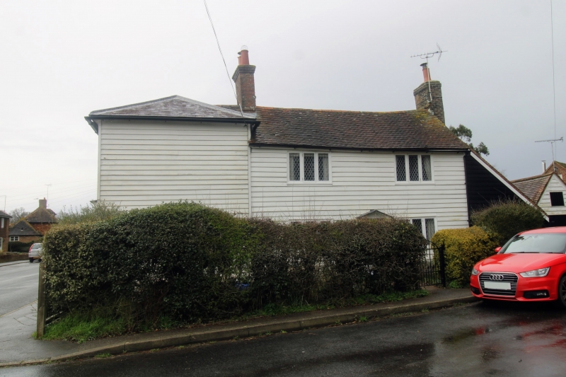
ROLVENDEN MAYTHAM ROAD
1.
5272 (north-west side)
Rolvenden Layne
No 48
TQ 8530 20/336
II GV
2.
House is C18, 2 storeys weatherboarded, tiled roof. Two casement windows
and pedimented doorcase.
Listing NGR: TQ8541530170
External links are from the relevant listing authority and, where applicable, Wikidata. Wikidata IDs may be related buildings as well as this specific building. If you want to add or update a link, you will need to do so by editing the Wikidata entry.


Other nearby listed buildings
