Approximate Location Map
Large Map »
Latitude: 51.0506 / 51°3'2"N
Longitude: 0.6424 / 0°38'32"E
OS Eastings: 585299
OS Northings: 131240
OS Grid: TQ852312
Mapcode National: GBR QWF.16X
Mapcode Global: FRA D67B.N31
Plus Code: 9F323J2R+6W
Entry Name: Woolwich Farmhouse
Listing Date: 9 August 1979
Grade: II
Source: Historic England
Source ID: 1070899
English Heritage Legacy ID: 180389
ID on this website: 101070899
Location: Rolvenden, Ashford, Kent, TN17
County: Kent
District: Ashford
Civil Parish: Rolvenden
Traditional County: Kent
Lieutenancy Area (Ceremonial County): Kent
Tagged with: Farmhouse
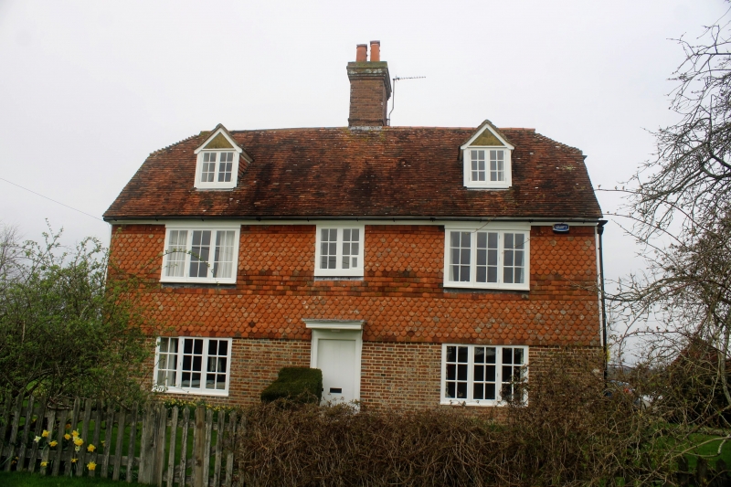
ROLVENDEN PIX'S LANE
1.
5272
Woolwich Farmhouse
TQ 83 SE 8/344
II
2.
C18. Two storeys and attics. Ground floor red brick, above tile hung. Tiled
roof with 2 gabled dormers. Three casement windows. Doorcase with flat hood over.
Listing NGR: TQ8529931240
External links are from the relevant listing authority and, where applicable, Wikidata. Wikidata IDs may be related buildings as well as this specific building. If you want to add or update a link, you will need to do so by editing the Wikidata entry.


Other nearby listed buildings
