Approximate Location Map
Large Map »
Latitude: 51.0533 / 51°3'11"N
Longitude: 0.6276 / 0°37'39"E
OS Eastings: 584251
OS Northings: 131502
OS Grid: TQ842315
Mapcode National: GBR QW6.X1Y
Mapcode Global: FRA D66B.GBN
Plus Code: 9F323J3H+82
Entry Name: Lime House
Listing Date: 16 August 1962
Last Amended: 9 August 1979
Grade: II
Source: Historic England
Source ID: 1362935
English Heritage Legacy ID: 180395
ID on this website: 101362935
Location: Rolvenden, Ashford, Kent, TN17
County: Kent
District: Ashford
Civil Parish: Rolvenden
Built-Up Area: Rolvenden
Traditional County: Kent
Lieutenancy Area (Ceremonial County): Kent
Tagged with: House
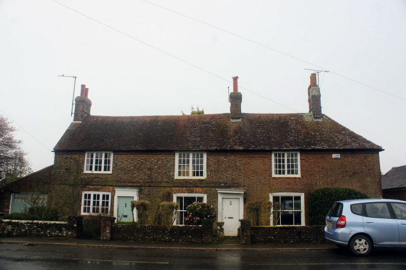
ROLVENDEN REGENT STREET
1.
5272 (south side)
No 24
No 26 (Lime House)
(formerly listed under
Benenden Road)
TQ 8431 18/260 16.8.62.
II
2.
Cl8. Two storeys red brick. Hipped tiled roof with modillion eaves cornice.
Stringcourse. Three windows in all. Mostly casement windows but 2 sash windows
with vertical glazing bars intact. Doorcases in moulded architrave surrounds
with flat hoods over.
Listing NGR: TQ8424531500
External links are from the relevant listing authority and, where applicable, Wikidata. Wikidata IDs may be related buildings as well as this specific building. If you want to add or update a link, you will need to do so by editing the Wikidata entry.


Other nearby listed buildings
