Approximate Location Map
Large Map »
Latitude: 51.0403 / 51°2'25"N
Longitude: 0.6015 / 0°36'5"E
OS Eastings: 582474
OS Northings: 129994
OS Grid: TQ824299
Mapcode National: GBR QWC.NX3
Mapcode Global: FRA D64C.J58
Plus Code: 9F322JR2+4H
Entry Name: Barn at Kensham Farm to North of Farmhouse
Listing Date: 9 August 1979
Grade: II
Source: Historic England
Source ID: 1335866
English Heritage Legacy ID: 180398
ID on this website: 101335866
Location: Ashford, Kent, TN17
County: Kent
District: Ashford
Civil Parish: Rolvenden
Traditional County: Kent
Lieutenancy Area (Ceremonial County): Kent
Tagged with: Barn
ROLVENDEN SANDHURST ROAD
1.
5272
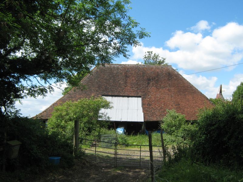
Barn at Kensham Farm
to north of farmhouse
TQ 82 NW 11/361A
II
2.
C18. One storey weatherboarded. Hipped tiled roof of Queen strut construction.
Later outshuts.
Listing NGR: TQ8279330425
External links are from the relevant listing authority and, where applicable, Wikidata. Wikidata IDs may be related buildings as well as this specific building. If you want to add or update a link, you will need to do so by editing the Wikidata entry.


Other nearby listed buildings
