Approximate Location Map
Large Map »
Latitude: 51.0379 / 51°2'16"N
Longitude: 0.6382 / 0°38'17"E
OS Eastings: 585057
OS Northings: 129817
OS Grid: TQ850298
Mapcode National: GBR QWF.S6X
Mapcode Global: FRA D67C.LH3
Plus Code: 9F322JQQ+57
Entry Name: Thornden Farmhouse
Listing Date: 16 August 1962
Last Amended: 9 August 1979
Grade: II
Source: Historic England
Source ID: 1086973
English Heritage Legacy ID: 180407
ID on this website: 101086973
Location: Rolvenden Layne, Ashford, Kent, TN17
County: Kent
District: Ashford
Civil Parish: Rolvenden
Traditional County: Kent
Lieutenancy Area (Ceremonial County): Kent
Tagged with: Farmhouse
ROLVENDEN THORNDEN LANE
1.
5272 Rolvenden Layne
Thornden Farmhouse
(formerly listed as s
Thornden)
TQ 82 NE 12/353 16.8.62.
II
2.
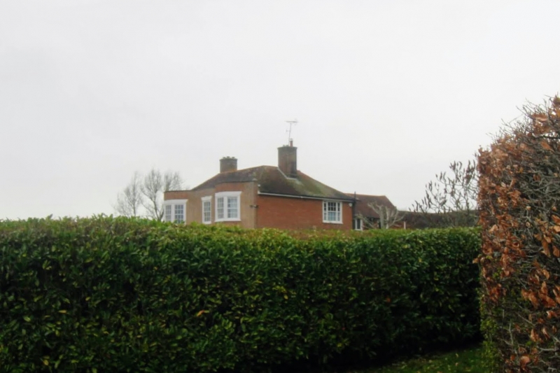
C18. Two storeys red brick. Tiled roof with parapet. Seven sashes with
glazing bars intact Including 2 bays of 3 windows each on both floors. Doorcase
with pilasters, pediment, semi-circular fanlight and door of 6 fielded panels.
T-wing behind.
Listing NGR: TQ8505729817
External links are from the relevant listing authority and, where applicable, Wikidata. Wikidata IDs may be related buildings as well as this specific building. If you want to add or update a link, you will need to do so by editing the Wikidata entry.


Other nearby listed buildings
