Approximate Location Map
Large Map »
Latitude: 51.2097 / 51°12'34"N
Longitude: 0.7944 / 0°47'40"E
OS Eastings: 595285
OS Northings: 149317
OS Grid: TQ952493
Mapcode National: GBR RW0.3PC
Mapcode Global: VHKK6.QVCK
Plus Code: 9F326Q5V+VQ
Entry Name: Eliza Cottages
Listing Date: 10 October 1980
Grade: II
Source: Historic England
Source ID: 1366085
English Heritage Legacy ID: 180685
ID on this website: 101366085
Location: Charing, Ashford, Kent, TN27
County: Kent
District: Ashford
Civil Parish: Charing
Built-Up Area: Charing
Traditional County: Kent
Lieutenancy Area (Ceremonial County): Kent
Tagged with: Cottage
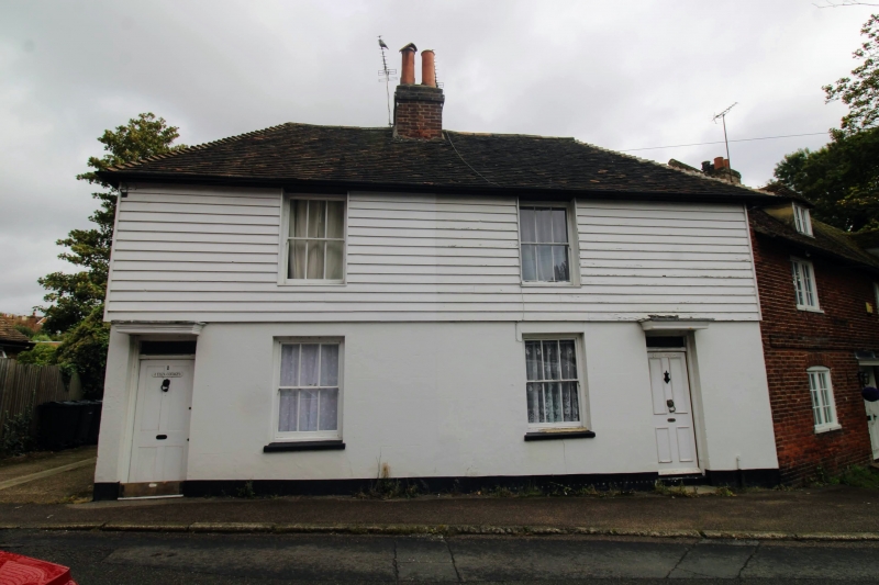
1.
5272 CHARING ASHFORD ROAD
Eliza Cottages
(Nos 1 and 2)
TQ 9549 22/83
II GV
2.
Dated 1873. Two storeys cement rendered. Hipped tiled roof. One sash to
each. Simple doorcases with rectangular fanlights and wooden weatherhoods.
Included for group value.
Listing NGR: TQ9528549316
External links are from the relevant listing authority and, where applicable, Wikidata. Wikidata IDs may be related buildings as well as this specific building. If you want to add or update a link, you will need to do so by editing the Wikidata entry.


Other nearby listed buildings
