Approximate Location Map
Large Map »
Latitude: 51.2096 / 51°12'34"N
Longitude: 0.7597 / 0°45'35"E
OS Eastings: 592861
OS Northings: 149217
OS Grid: TQ928492
Mapcode National: GBR RVZ.0WZ
Mapcode Global: VHKK6.4V0L
Plus Code: 9F326Q55+RV
Entry Name: The Red Lion Inn
Listing Date: 14 February 1967
Grade: II
Source: Historic England
Source ID: 1362992
English Heritage Legacy ID: 180703
Also known as: Red Lion
The Red Lion, Ashford
ID on this website: 101362992
1.
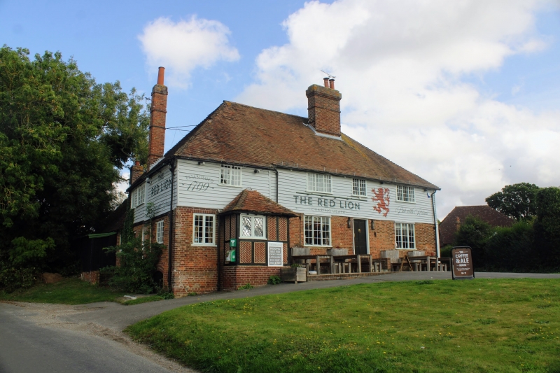
5272 CHARING CHARING HEATH ROAD
Charing Heath
The Red Lion Inn
TQ 94 NW 10/68 14.2.67
II
2.
C18 exterior to a timber-framed building. Steeply-pitched hipped tiled roof
with large modern brick chimney stack. Four modern casement windows. Later
porch built on. Heavily restored.
Listing NGR: TQ9286149217
External links are from the relevant listing authority and, where applicable, Wikidata. Wikidata IDs may be related buildings as well as this specific building. If you want to add or update a link, you will need to do so by editing the Wikidata entry.


Other nearby listed buildings
