Approximate Location Map
Large Map »
Latitude: 51.2111 / 51°12'39"N
Longitude: 0.7537 / 0°45'13"E
OS Eastings: 592433
OS Northings: 149367
OS Grid: TQ924493
Mapcode National: GBR RVY.5C0
Mapcode Global: VHKK6.0TTG
Plus Code: 9F326Q63+CF
Entry Name: Fayre Acre
Listing Date: 10 October 1980
Grade: II
Source: Historic England
Source ID: 1070773
English Heritage Legacy ID: 180706
ID on this website: 101070773
Location: Charing Heath, Ashford, Kent, TN27
County: Kent
District: Ashford
Civil Parish: Charing
Built-Up Area: Charing Heath
Traditional County: Kent
Lieutenancy Area (Ceremonial County): Kent
Tagged with: Building
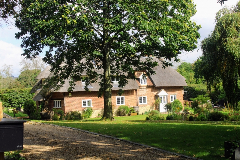
1.
5272 CHARING CHURCH HILL
Charing Heath
Fayre Acre
TQ 94 NW 10/64
II
2.
C18. Two storeys. Ground floor red brick, above tile-hung. Hipped tiled
roof with pentice to east and west. Two casement windows.
Listing NGR: TQ9243349367
External links are from the relevant listing authority and, where applicable, Wikidata. Wikidata IDs may be related buildings as well as this specific building. If you want to add or update a link, you will need to do so by editing the Wikidata entry.


Other nearby listed buildings
