Approximate Location Map
Large Map »
Latitude: 51.2014 / 51°12'4"N
Longitude: 0.7403 / 0°44'25"E
OS Eastings: 591537
OS Northings: 148252
OS Grid: TQ915482
Mapcode National: GBR RVY.MYS
Mapcode Global: VHKKC.S27C
Plus Code: 9F326P2R+G4
Entry Name: Field Mill (The Mill Building)
Listing Date: 14 February 1967
Grade: II
Source: Historic England
Source ID: 1070775
English Heritage Legacy ID: 180714
ID on this website: 101070775
Location: Stonebridge Green, Ashford, Kent, TN27
County: Kent
District: Ashford
Civil Parish: Egerton
Traditional County: Kent
Lieutenancy Area (Ceremonial County): Kent
Tagged with: Mill building
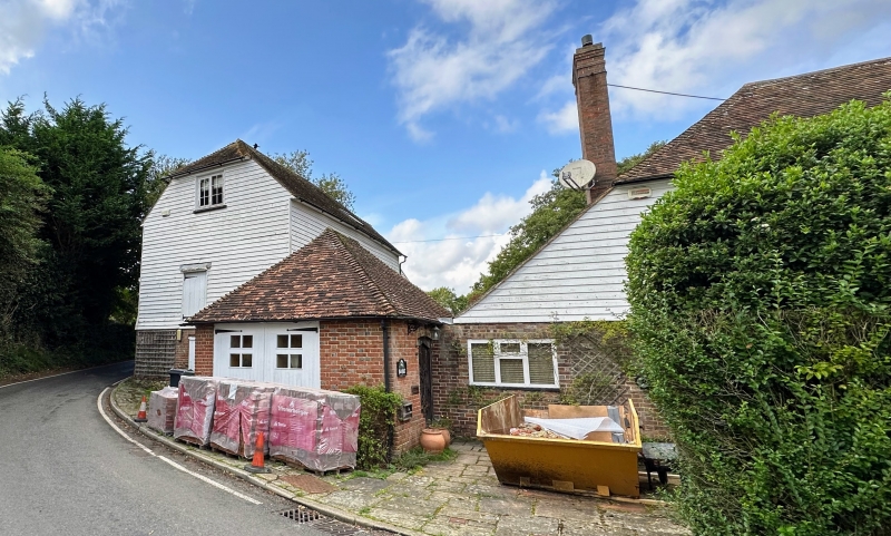
1.
5272 CHARING EGERTON ROAD
Field Mill
(the mill building)
TQ 94 NW 10/79A 14.2.67
II GV
2.
C18 water mill. Two storeys and attics. Ground floor red brick on a stone
base, above white weatherboarding. Half-hipped tiled roof. Casement windows.
Listing NGR: TQ9242549005
External links are from the relevant listing authority and, where applicable, Wikidata. Wikidata IDs may be related buildings as well as this specific building. If you want to add or update a link, you will need to do so by editing the Wikidata entry.


Other nearby listed buildings
