Approximate Location Map
Large Map »
Latitude: 51.2103 / 51°12'37"N
Longitude: 0.794 / 0°47'38"E
OS Eastings: 595253
OS Northings: 149390
OS Grid: TQ952493
Mapcode National: GBR RW0.3KV
Mapcode Global: VHKK6.QV41
Plus Code: 9F326Q6V+4J
Entry Name: Former Stable to Rear of Nos 27 and 29 (Sherborne House)
Listing Date: 10 October 1980
Grade: II
Source: Historic England
Source ID: 1070741
English Heritage Legacy ID: 180730
ID on this website: 101070741
Location: Charing, Ashford, Kent, TN27
County: Kent
District: Ashford
Civil Parish: Charing
Built-Up Area: Charing
Traditional County: Kent
Lieutenancy Area (Ceremonial County): Kent
Tagged with: Stable
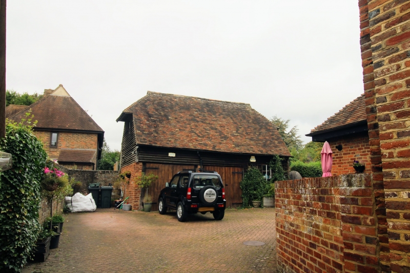
1.
5272 CHARING HIGH STREET
(west side)
Former stable to
rear of
Nos 27 and 29
(Sherborne House)
TQ 9549 22/39A
II GV
2.
C18. One storey weatherboarded. Half-hipped tiled roof.
Listing NGR: TQ9525449391
External links are from the relevant listing authority and, where applicable, Wikidata. Wikidata IDs may be related buildings as well as this specific building. If you want to add or update a link, you will need to do so by editing the Wikidata entry.


Other nearby listed buildings
