Approximate Location Map
Large Map »
Latitude: 51.2095 / 51°12'34"N
Longitude: 0.7939 / 0°47'37"E
OS Eastings: 595245
OS Northings: 149302
OS Grid: TQ952493
Mapcode National: GBR RW0.3HY
Mapcode Global: VHKK6.QV1N
Plus Code: 9F326Q5V+RG
Entry Name: 10 and 12, High Street
Listing Date: 14 February 1967
Last Amended: 10 October 1980
Grade: II
Source: Historic England
Source ID: 1185788
English Heritage Legacy ID: 180747
ID on this website: 101185788
Location: Charing, Ashford, Kent, TN27
County: Kent
District: Ashford
Civil Parish: Charing
Built-Up Area: Charing
Traditional County: Kent
Lieutenancy Area (Ceremonial County): Kent
Tagged with: Building
1.
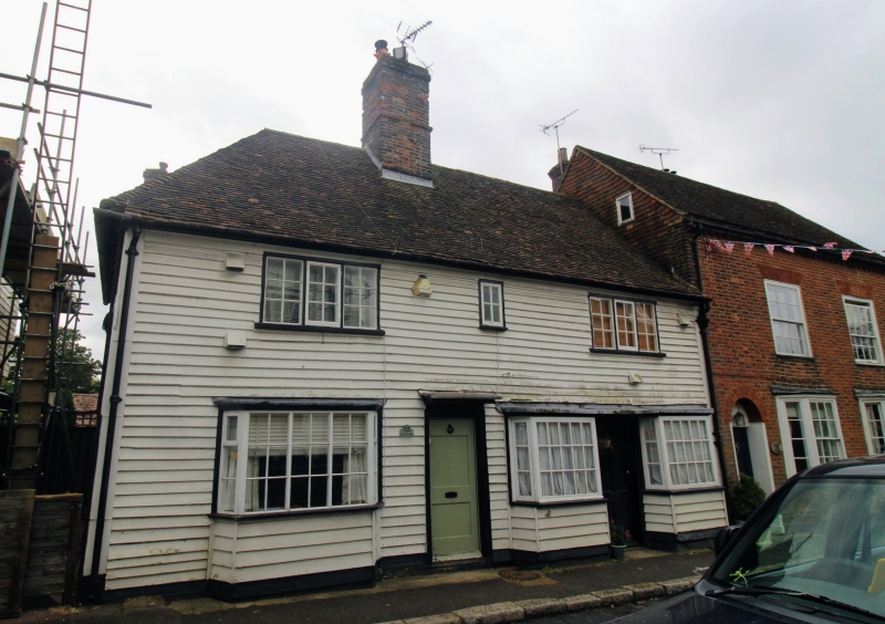
5272 CHARING HIGH STREET
(east side)
Nos 10 and 12
(formerly listed as
Nos 1 and 2 Spring
Cottage)
TQ 9549 22/25 14.2.67
II GV
2.
C17 or earlier timber-framed building, with the timbering exposed and plaster
infilling in the north wall, but refronted with weatherboarding. Tiled roof.
Two casement windows to first floor. Three small bays on the ground floor.
Doorcases with flat hoods over.
Listing NGR: TQ9524749302
External links are from the relevant listing authority and, where applicable, Wikidata. Wikidata IDs may be related buildings as well as this specific building. If you want to add or update a link, you will need to do so by editing the Wikidata entry.


Other nearby listed buildings
