Approximate Location Map
Large Map »
Latitude: 51.2105 / 51°12'37"N
Longitude: 0.7947 / 0°47'40"E
OS Eastings: 595298
OS Northings: 149412
OS Grid: TQ952494
Mapcode National: GBR RW0.3Q5
Mapcode Global: VHKK6.QTHW
Plus Code: 9F326Q6V+6V
Entry Name: 44-48, High Street
Listing Date: 10 October 1980
Grade: II
Source: Historic England
Source ID: 1070752
English Heritage Legacy ID: 180756
ID on this website: 101070752
Location: Charing, Ashford, Kent, TN27
County: Kent
District: Ashford
Civil Parish: Charing
Built-Up Area: Ashford (Ashford)
Traditional County: Kent
Lieutenancy Area (Ceremonial County): Kent
Tagged with: Building
1.
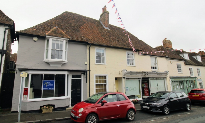
5272 CHARING HIGH STREET
(east side)
Nos 44 to 48 (even)
TQ 9549 22/19A
II GV
2.
A C15 to C16 timber-framed building, possibly of Wealden pattern. Two storeys,
refronted with mathematical tiles. Steeply-pitched tiled roof. Four sashes
in all, one a 3-light bay. Two C19 shop-fronts.
Listing NGR: TQ9529849406
External links are from the relevant listing authority and, where applicable, Wikidata. Wikidata IDs may be related buildings as well as this specific building. If you want to add or update a link, you will need to do so by editing the Wikidata entry.


Other nearby listed buildings
