Approximate Location Map
Large Map »
Latitude: 51.2129 / 51°12'46"N
Longitude: 0.7448 / 0°44'41"E
OS Eastings: 591801
OS Northings: 149547
OS Grid: TQ918495
Mapcode National: GBR RVR.WN0
Mapcode Global: VHKK5.VSL1
Plus Code: 9F326P7V+5W
Entry Name: Wilks Farmhouse
Listing Date: 10 October 1980
Grade: II
Source: Historic England
Source ID: 1185842
English Heritage Legacy ID: 180766
ID on this website: 101185842
Location: Lenham Heath, Ashford, Kent, ME17
County: Kent
District: Ashford
Civil Parish: Charing
Built-Up Area: Lenham Heath
Traditional County: Kent
Lieutenancy Area (Ceremonial County): Kent
Tagged with: Farmhouse
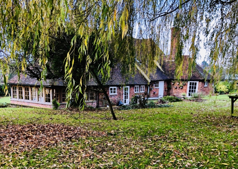
1.
5272 CHARING MAGAZINE ROAD
Wilks Farmhouse
TQ 94 NW 10/98
II
2.
C18 or earlier. Two storeys red brick. Tiled roof. Four casement windows.
Simple cambered doorcase. Left side portion is weatherboarded and has a hipped
roof. This is probably an C18 refacing of an earlier timber-framed building.
Listing NGR: TQ9180149547
External links are from the relevant listing authority and, where applicable, Wikidata. Wikidata IDs may be related buildings as well as this specific building. If you want to add or update a link, you will need to do so by editing the Wikidata entry.


Other nearby listed buildings
