Approximate Location Map
Large Map »
Latitude: 51.2106 / 51°12'38"N
Longitude: 0.7949 / 0°47'41"E
OS Eastings: 595314
OS Northings: 149424
OS Grid: TQ953494
Mapcode National: GBR RW0.3SB
Mapcode Global: VHKK6.QTLT
Plus Code: 9F326Q6V+6X
Entry Name: 3, Market Place
Listing Date: 10 October 1980
Grade: II
Source: Historic England
Source ID: 1071535
English Heritage Legacy ID: 180775
ID on this website: 101071535
Location: Charing, Ashford, Kent, TN27
County: Kent
District: Ashford
Civil Parish: Charing
Built-Up Area: Charing
Traditional County: Kent
Lieutenancy Area (Ceremonial County): Kent
Tagged with: Building
1.
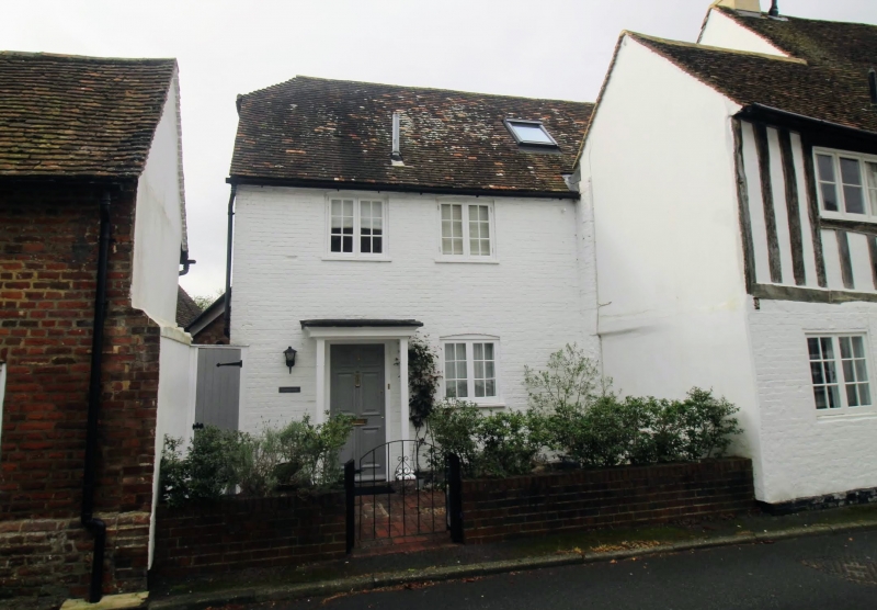
5272 CHARING MARKET PLACE
No 3
TQ 9549 22/10
II
2.
C18 exterior. Two storeys. Ground floor red brick, above imitation timber-framing.
Tiled roof. Two casement windows. Six fielded panelled door and later wooden
porc.
Listing NGR: TQ9531249424
External links are from the relevant listing authority and, where applicable, Wikidata. Wikidata IDs may be related buildings as well as this specific building. If you want to add or update a link, you will need to do so by editing the Wikidata entry.


Other nearby listed buildings
