Approximate Location Map
Large Map »
Latitude: 51.211 / 51°12'39"N
Longitude: 0.7943 / 0°47'39"E
OS Eastings: 595271
OS Northings: 149467
OS Grid: TQ952494
Mapcode National: GBR RW0.3MS
Mapcode Global: VHKK6.QT9H
Plus Code: 9F326Q6V+CP
Entry Name: Stable to the North West of Ledbury House
Listing Date: 25 July 1978
Grade: II
Source: Historic England
Source ID: 1186092
English Heritage Legacy ID: 180790
ID on this website: 101186092
Location: Charing, Ashford, Kent, TN27
County: Kent
District: Ashford
Town: Ashford
Civil Parish: Charing
Built-Up Area: Charing
Traditional County: Kent
Lieutenancy Area (Ceremonial County): Kent
Tagged with: Stable
1.
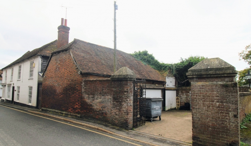
5272 CHARING SCHOOL ROAD
Stable to the north-west
of Ledbury House
TQ 9549 22/104 25.7.78
II
2.
C18. One storey red brick. Half-hipped tiled roof with hipped projection.
Stable doors.
Listing NGR: TQ9527149467
External links are from the relevant listing authority and, where applicable, Wikidata. Wikidata IDs may be related buildings as well as this specific building. If you want to add or update a link, you will need to do so by editing the Wikidata entry.


Other nearby listed buildings
