Approximate Location Map
Large Map »
Latitude: 51.1893 / 51°11'21"N
Longitude: 0.7023 / 0°42'8"E
OS Eastings: 588935
OS Northings: 146815
OS Grid: TQ889468
Mapcode National: GBR QTR.BCY
Mapcode Global: VHKKC.4C4M
Plus Code: 9F325PQ2+PW
Entry Name: Stormgard
Listing Date: 14 February 1967
Last Amended: 10 October 1980
Grade: II
Source: Historic England
Source ID: 1071551
English Heritage Legacy ID: 180817
ID on this website: 101071551
Location: Potter's Forstal, Ashford, Kent, TN27
County: Kent
District: Ashford
Civil Parish: Egerton
Traditional County: Kent
Lieutenancy Area (Ceremonial County): Kent
Tagged with: Building
1.
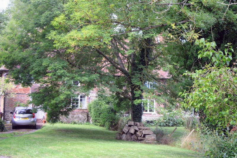
5272 EGERTON CHAPEL ROAD
Potters Forstal
Stormgard
(formerly listed as
Mount Pleasant)
TQ 84 NE 9/41 14.2.67
II
2.
Probably timber-framed. C17 or earlier. Two storeys. Ground floor red brick
on a stone base, above tile-hung. Steeply-pitched hipped tiled roof. Four
casement windows.
Listing NGR: TQ8893546815
External links are from the relevant listing authority and, where applicable, Wikidata. Wikidata IDs may be related buildings as well as this specific building. If you want to add or update a link, you will need to do so by editing the Wikidata entry.


Other nearby listed buildings
