Approximate Location Map
Large Map »
Latitude: 51.1898 / 51°11'23"N
Longitude: 0.7062 / 0°42'22"E
OS Eastings: 589205
OS Northings: 146878
OS Grid: TQ892468
Mapcode National: GBR QTR.CCS
Mapcode Global: VHKKC.6C67
Plus Code: 9F325PQ4+WF
Entry Name: Island Farmhouse
Listing Date: 14 February 1967
Grade: II
Source: Historic England
Source ID: 1071552
English Heritage Legacy ID: 180821
ID on this website: 101071552
Location: Potter's Forstal, Ashford, Kent, TN27
County: Kent
District: Ashford
Civil Parish: Egerton
Traditional County: Kent
Lieutenancy Area (Ceremonial County): Kent
Tagged with: Farmhouse
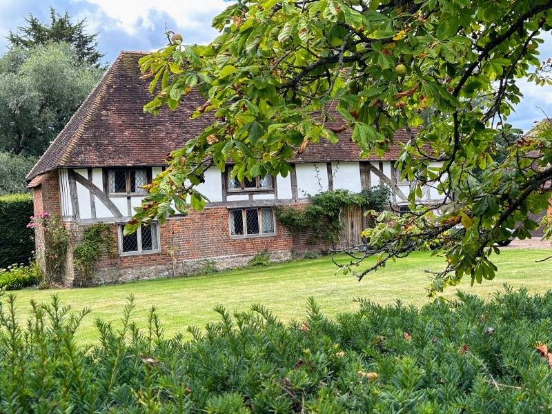
1.
5272 EGERTON CROSS ROAD
Island Farmhouse
TQ 84 NE 9/40 14.2.67
II
2.
C17 or earlier L-shaped timber-framed building on a stone base, with the
timber-framing exposed in the north-west wall, but otherwise refaced with red brick on the ground floor and tile-hung above. Hipped tiled roof. Three
casement windows.
Listing NGR: TQ8920546877
External links are from the relevant listing authority and, where applicable, Wikidata. Wikidata IDs may be related buildings as well as this specific building. If you want to add or update a link, you will need to do so by editing the Wikidata entry.


Other nearby listed buildings
