Approximate Location Map
Large Map »
Latitude: 51.2051 / 51°12'18"N
Longitude: 0.7204 / 0°43'13"E
OS Eastings: 590134
OS Northings: 148612
OS Grid: TQ901486
Mapcode National: GBR QTL.8ZP
Mapcode Global: VHKK5.FZQ2
Plus Code: 9F326P4C+25
Entry Name: Weatherboarded Barn to North East of Buscombe Farmhouse
Listing Date: 10 October 1980
Grade: II
Source: Historic England
Source ID: 1362616
English Heritage Legacy ID: 180824
ID on this website: 101362616
Location: Ashford, Kent, TN27
County: Kent
District: Ashford
Civil Parish: Egerton
Traditional County: Kent
Lieutenancy Area (Ceremonial County): Kent
Tagged with: Agricultural structure
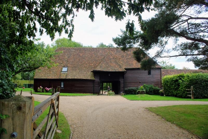
1.
5272 EGERTON FIELD FARM ROAD
Weatherboarded barn to
north-east of
Burscombe Farmhouse
TQ 94 NW 10/32A
II
2.
C18 or earlier. One storey weatherboarded. Hipped tiled roof with hipped
pentice.
Listing NGR: TQ9008448584
External links are from the relevant listing authority and, where applicable, Wikidata. Wikidata IDs may be related buildings as well as this specific building. If you want to add or update a link, you will need to do so by editing the Wikidata entry.


Other nearby listed buildings
