Approximate Location Map
Large Map »
Latitude: 51.184 / 51°11'2"N
Longitude: 0.7084 / 0°42'30"E
OS Eastings: 589383
OS Northings: 146236
OS Grid: TQ893462
Mapcode National: GBR QTR.RX3
Mapcode Global: VHKKC.7HCQ
Plus Code: 9F325PM5+H9
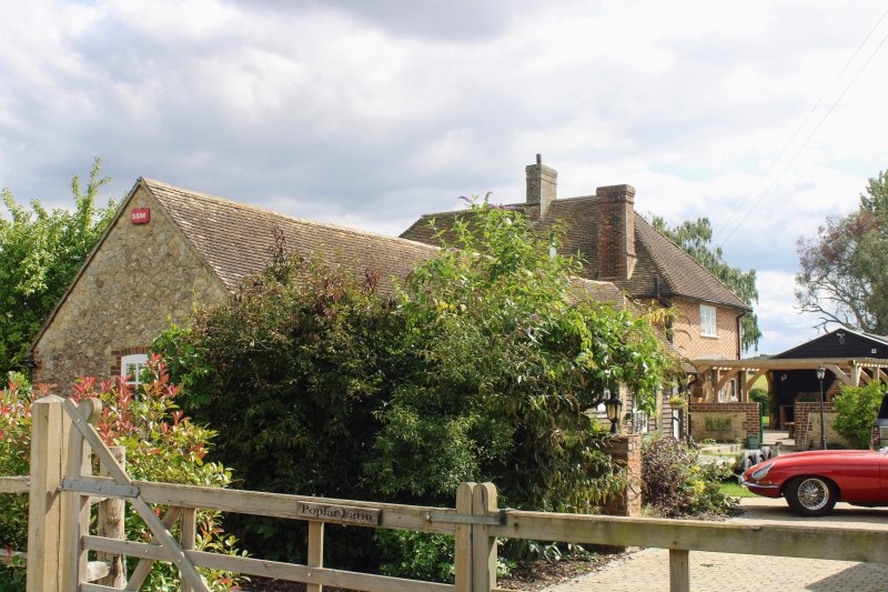
Entry Name: Poplar Farmhouse
Listing Date: 10 October 1980
Grade: II
Source: Historic England
Source ID: 1071514
English Heritage Legacy ID: 180826
ID on this website: 101071514
Location: Egerton Forstal, Ashford, Kent, TN27
County: Kent
District: Ashford
Civil Parish: Egerton
Traditional County: Kent
Lieutenancy Area (Ceremonial County): Kent
Tagged with: Farmhouse
1.
5272 EGERTON FORGE LANE
Egerton Forstal
Poplar Farmhouse
TQ 84 NE 9/47
II
2.
C18. Two storeys red brick and grey headers alternately on a stone base.
Hipped tiled roof. Two casement windows. Doorcase with rectangular fanlight
and flat hood over on brackets.
Listing NGR: TQ8938346235
External links are from the relevant listing authority and, where applicable, Wikidata. Wikidata IDs may be related buildings as well as this specific building. If you want to add or update a link, you will need to do so by editing the Wikidata entry.


Other nearby listed buildings
