Approximate Location Map
Large Map »
Latitude: 51.1925 / 51°11'32"N
Longitude: 0.7243 / 0°43'27"E
OS Eastings: 590457
OS Northings: 147221
OS Grid: TQ904472
Mapcode National: GBR QTS.3YH
Mapcode Global: VHKKC.H9R6
Plus Code: 9F325PRF+XP
Entry Name: Rock Hill House
Listing Date: 14 February 1967
Last Amended: 10 October 1980
Grade: II
Source: Historic England
Source ID: 1362618
English Heritage Legacy ID: 180835
ID on this website: 101362618
Location: Egerton, Ashford, Kent, TN27
County: Kent
District: Ashford
Civil Parish: Egerton
Traditional County: Kent
Lieutenancy Area (Ceremonial County): Kent
Tagged with: House
1.
5272 EGERTON LOWER STREET
Rock Hill House
(formerly listed as
Rock Hill Farmhouse)
TQ 94 NW 10/13 14.2.67
II
2.
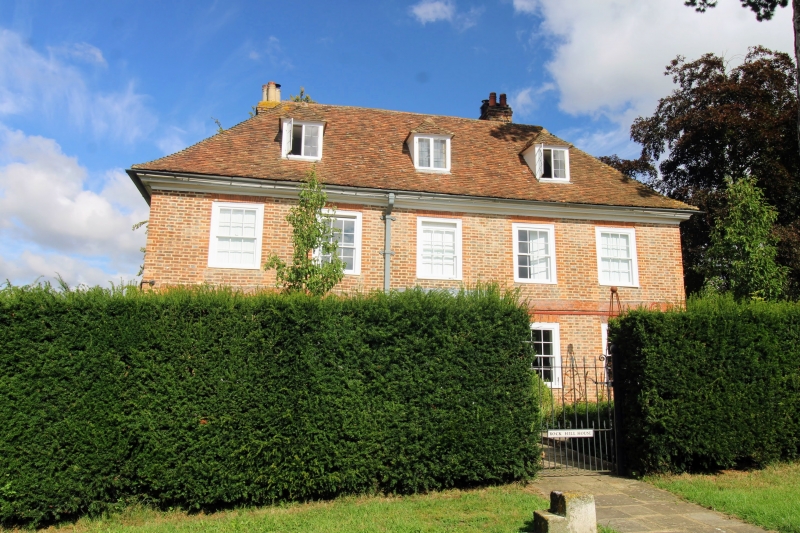
Rebuilt in 1721, but Tudor in origin. Two storeys and attics red brick and
grey headers on a stone base. Hipped tiled roof with 3 hipped dormers. Moulded
wooden eaves cornice. Brick stringcourse. Five sashes with glazing bars intact
Tuscan porch. The south-west wall has 2 buttresses.
Listing NGR: TQ9045347219
External links are from the relevant listing authority and, where applicable, Wikidata. Wikidata IDs may be related buildings as well as this specific building. If you want to add or update a link, you will need to do so by editing the Wikidata entry.


Other nearby listed buildings
