Approximate Location Map
Large Map »
Latitude: 51.1924 / 51°11'32"N
Longitude: 0.7244 / 0°43'27"E
OS Eastings: 590466
OS Northings: 147209
OS Grid: TQ904472
Mapcode National: GBR QTS.3ZM
Mapcode Global: VHKKC.H9T8
Plus Code: 9F325PRF+WQ
Entry Name: Mounting Block Opposite Rock Hill House
Listing Date: 10 October 1980
Grade: II
Source: Historic England
Source ID: 1319909
English Heritage Legacy ID: 180836
ID on this website: 101319909
Location: Egerton, Ashford, Kent, TN27
County: Kent
District: Ashford
Civil Parish: Egerton
Traditional County: Kent
Lieutenancy Area (Ceremonial County): Kent
Tagged with: House
1.
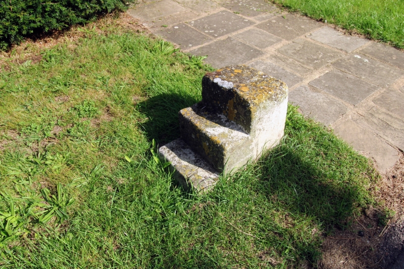
5272 EGERTON LOWER STREET
Mounting block opposite
Rock Hill House
TQ 94 NW 10/13A
II
2.
Probably C18 mounting block, having 2 steps carved out of a single stone block.
Listing NGR: TQ9046647209
External links are from the relevant listing authority and, where applicable, Wikidata. Wikidata IDs may be related buildings as well as this specific building. If you want to add or update a link, you will need to do so by editing the Wikidata entry.


Other nearby listed buildings
