Approximate Location Map
Large Map »
Latitude: 51.1926 / 51°11'33"N
Longitude: 0.7236 / 0°43'24"E
OS Eastings: 590408
OS Northings: 147236
OS Grid: TQ904472
Mapcode National: GBR QTS.3RY
Mapcode Global: VHKKC.H9D2
Plus Code: 9F325PVF+2C
Entry Name: Range of Barns and Cartsheds 50 Metres to West of Rock Hill House
Listing Date: 10 October 1980
Grade: II
Source: Historic England
Source ID: 1071521
English Heritage Legacy ID: 180837
ID on this website: 101071521
Location: Egerton, Ashford, Kent, TN27
County: Kent
District: Ashford
Civil Parish: Egerton
Traditional County: Kent
Lieutenancy Area (Ceremonial County): Kent
Tagged with: Barn
1.
5272 EGERTON LOWER STREET
Range of barns and
cartsheds 50 metres
to west of
Rock Hill House
TQ 94 NW 10/13B
II
2.
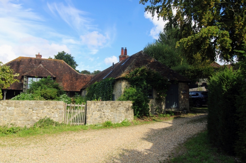
M-shape. The centre is an aisled C18 or earlier timber barn faced with red
brick, with hipped tiled roof. Attached to this are 2 C19 ranges of one storey
Kentish ragstone.
Listing NGR: TQ9045347219
External links are from the relevant listing authority and, where applicable, Wikidata. Wikidata IDs may be related buildings as well as this specific building. If you want to add or update a link, you will need to do so by editing the Wikidata entry.


Other nearby listed buildings
