Approximate Location Map
Large Map »
Latitude: 51.193 / 51°11'34"N
Longitude: 0.7257 / 0°43'32"E
OS Eastings: 590552
OS Northings: 147289
OS Grid: TQ905472
Mapcode National: GBR QTS.49J
Mapcode Global: VHKKC.J8HR
Plus Code: 9F325PVG+67
Entry Name: The Old Vicarage
Listing Date: 14 February 1967
Grade: II
Source: Historic England
Source ID: 1116511
English Heritage Legacy ID: 180839
ID on this website: 101116511
Location: Egerton, Ashford, Kent, TN27
County: Kent
District: Ashford
Civil Parish: Egerton
Traditional County: Kent
Lieutenancy Area (Ceremonial County): Kent
Tagged with: Clergy house
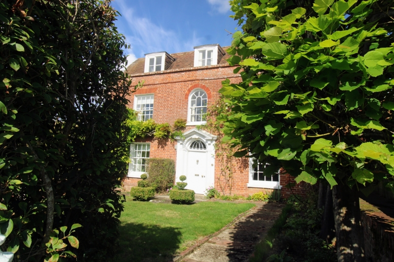
1.
5272 EGERTON LOWER STREET
The Old Vicarage
TQ 94 NW 10/12 14.2.67
II
2.
Circa 1800. Two storeys and attics red brick. Tiled roof with 3 dormers.
Parapet. Three sashes with glazing bars intact. Doorcase with fluted pilasters,
semi-circular fanlight and 6 panel door.
Listing NGR: TQ9054847288
External links are from the relevant listing authority and, where applicable, Wikidata. Wikidata IDs may be related buildings as well as this specific building. If you want to add or update a link, you will need to do so by editing the Wikidata entry.


Other nearby listed buildings
