Approximate Location Map
Large Map »
Latitude: 51.1777 / 51°10'39"N
Longitude: 0.7266 / 0°43'35"E
OS Eastings: 590680
OS Northings: 145588
OS Grid: TQ906455
Mapcode National: GBR QTZ.4HW
Mapcode Global: VHKKC.KN0J
Plus Code: 9F325PHG+3J
Entry Name: Mundy Bois House
Listing Date: 10 October 1980
Grade: II
Source: Historic England
Source ID: 1116516
English Heritage Legacy ID: 180841
ID on this website: 101116516
Location: Mundy Bois, Ashford, Kent, TN27
County: Kent
District: Ashford
Civil Parish: Egerton
Traditional County: Kent
Lieutenancy Area (Ceremonial County): Kent
Tagged with: House
1.
5272 EGERTON MUNDY BOIS
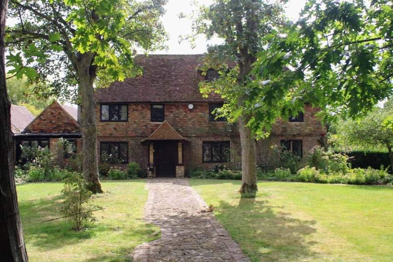
Mundy Bois House
TQ 94 NW 10/73
II
2.
C18 or earlier. Two storeys and attics. Ground floor red brick, above tile-hung.
Tiled roof with one gabled dormer. Four casement windows.
Listing NGR: TQ9068045588
External links are from the relevant listing authority and, where applicable, Wikidata. Wikidata IDs may be related buildings as well as this specific building. If you want to add or update a link, you will need to do so by editing the Wikidata entry.


Other nearby listed buildings
