Approximate Location Map
Large Map »
Latitude: 51.1822 / 51°10'56"N
Longitude: 0.7178 / 0°43'3"E
OS Eastings: 590042
OS Northings: 146067
OS Grid: TQ900460
Mapcode National: GBR QTS.VNV
Mapcode Global: VHKKC.DK91
Plus Code: 9F325PJ9+V4
Entry Name: Groom Farmhouse
Listing Date: 14 February 1967
Grade: II
Source: Historic England
Source ID: 1116487
English Heritage Legacy ID: 180843
ID on this website: 101116487
Location: Newland Green, Ashford, Kent, TN27
County: Kent
District: Ashford
Civil Parish: Egerton
Traditional County: Kent
Lieutenancy Area (Ceremonial County): Kent
Tagged with: Farmhouse
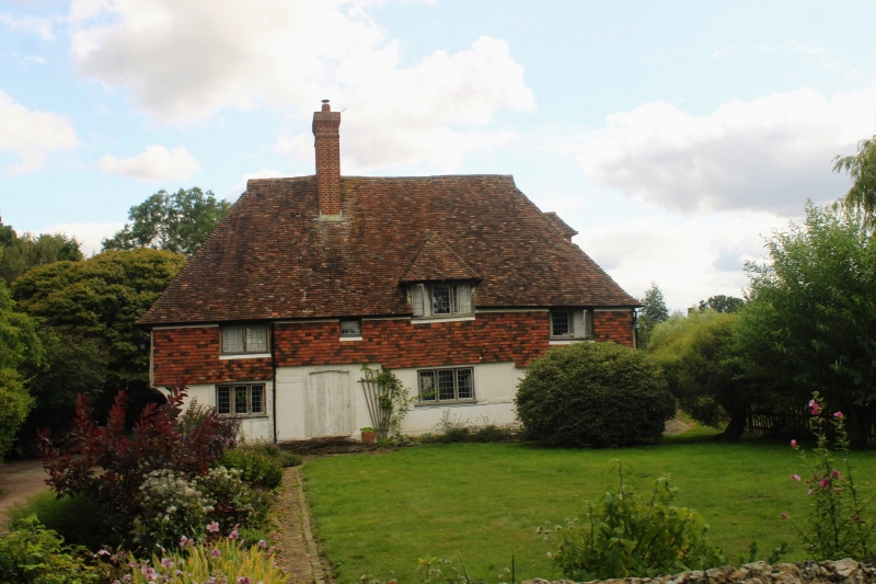
1.
5272 EGERTON NEWLAND GREEN
Groom Farmhouse
TQ 94 NW 10/26 14.2.67
II
2.
C15 to C16 timber-framed building with plaster infilling on a stone base.
The first floor has curved braces and originally oversailed on the north and
south fronts on the protruding ends of the floor joists, but the south front
has been underbuilt. Steeply-pitched hipped tiled roof. Four windows, some
casements and some sashes with glazing bars intact.
Listing NGR: TQ9004246067
External links are from the relevant listing authority and, where applicable, Wikidata. Wikidata IDs may be related buildings as well as this specific building. If you want to add or update a link, you will need to do so by editing the Wikidata entry.


Other nearby listed buildings
