Approximate Location Map
Large Map »
Latitude: 51.1984 / 51°11'54"N
Longitude: 0.7126 / 0°42'45"E
OS Eastings: 589616
OS Northings: 147845
OS Grid: TQ896478
Mapcode National: GBR QTL.T59
Mapcode Global: VHKKC.94LP
Plus Code: 9F325PX7+82
Entry Name: Hollis Farmhouse
Listing Date: 23 January 1980
Grade: II
Source: Historic England
Source ID: 1362621
English Heritage Legacy ID: 180850
ID on this website: 101362621
Location: Pembles Cross, Ashford, Kent, TN27
County: Kent
District: Ashford
Civil Parish: Egerton
Traditional County: Kent
Lieutenancy Area (Ceremonial County): Kent
Tagged with: Farmhouse
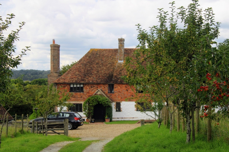
1.
5272 EGERTON STAR AND GARTER ROAD
Hollis Farmhouse
TQ 84 NE 9/34 23.1.80
II
2.
C17 exterior to a possibly C14 timber-framed hall-house. Two storeys, ground
floor stone rubble, whitewashed, above tile-hung. Hipped tiled roof. Three
casement windows. Doorcase with flat hood over.
Listing NGR: TQ8962347841
External links are from the relevant listing authority and, where applicable, Wikidata. Wikidata IDs may be related buildings as well as this specific building. If you want to add or update a link, you will need to do so by editing the Wikidata entry.


Other nearby listed buildings
