Approximate Location Map
Large Map »
Latitude: 51.1955 / 51°11'43"N
Longitude: 0.7054 / 0°42'19"E
OS Eastings: 589122
OS Northings: 147511
OS Grid: TQ891475
Mapcode National: GBR QTK.Z15
Mapcode Global: VHKKC.56RV
Plus Code: 9F325PW4+64
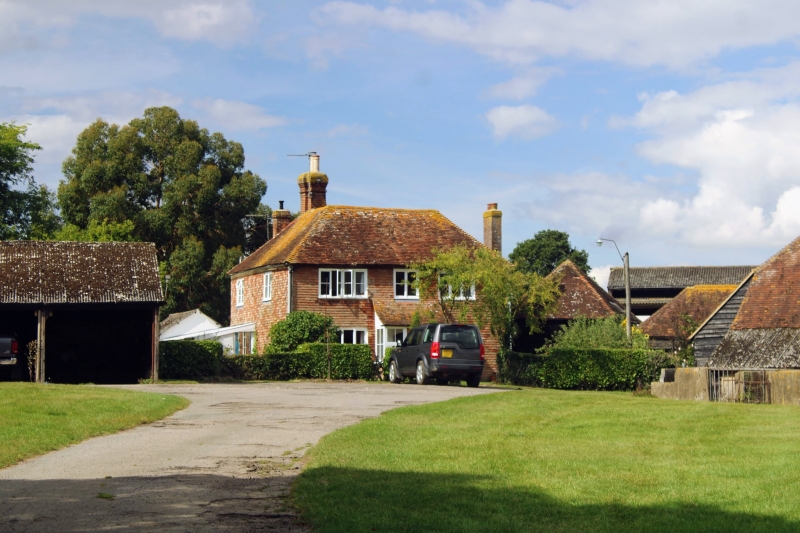
Entry Name: Hazeldene Farmhouse
Listing Date: 10 October 1980
Grade: II
Source: Historic England
Source ID: 1116472
English Heritage Legacy ID: 180854
ID on this website: 101116472
Location: Pembles Cross, Ashford, Kent, TN27
County: Kent
District: Ashford
Civil Parish: Egerton
Traditional County: Kent
Lieutenancy Area (Ceremonial County): Kent
Tagged with: Farmhouse
1.
5272 EGERTON STAR AND GARTER ROAD
Pembles Cross
Hazeldene Farmhouse
TQ 84 NE 9/35
II
2.
C18 or earlier. Two parallel ranges, 2 storeys tile-hung. Three casement
windows. Modern porch.
Listing NGR: TQ8917547535
External links are from the relevant listing authority and, where applicable, Wikidata. Wikidata IDs may be related buildings as well as this specific building. If you want to add or update a link, you will need to do so by editing the Wikidata entry.


Other nearby listed buildings
