Approximate Location Map
Large Map »
Latitude: 51.1991 / 51°11'56"N
Longitude: 0.72 / 0°43'12"E
OS Eastings: 590131
OS Northings: 147952
OS Grid: TQ901479
Mapcode National: GBR QTL.NW9
Mapcode Global: VHKKC.F4H2
Plus Code: 9F325PXC+M2
Entry Name: Egerton House
Listing Date: 14 February 1967
Grade: II
Source: Historic England
Source ID: 1071528
English Heritage Legacy ID: 180857
ID on this website: 101071528
Location: Egerton, Ashford, Kent, TN27
County: Kent
District: Ashford
Civil Parish: Egerton
Traditional County: Kent
Lieutenancy Area (Ceremonial County): Kent
Tagged with: House
1.
5272 EGERTON STAR AND GARTER ROAD
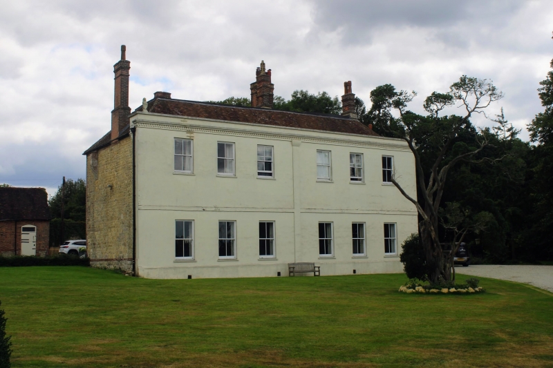
Egerton House
TQ 94 NW 10/31 14.2 .67
II
2.
L-shaped house with an early C19 exterior but some timber-framing inside.
Two storeys stuccoed. In the centre is a pilaster rising the whole height
of the building. Hipped tiled roof with modillion cornice and parapet. Six
sashes with glazing bars missing. The south front has a pentice to part of
it and in the angle formed by this is a wide square porch. Round-headed doorway
in this with side lights and semi-circular fanlight.
Listing NGR: TQ9013147952
External links are from the relevant listing authority and, where applicable, Wikidata. Wikidata IDs may be related buildings as well as this specific building. If you want to add or update a link, you will need to do so by editing the Wikidata entry.


Other nearby listed buildings
