Approximate Location Map
Large Map »
Latitude: 51.19 / 51°11'24"N
Longitude: 0.7282 / 0°43'41"E
OS Eastings: 590740
OS Northings: 146958
OS Grid: TQ907469
Mapcode National: GBR QTS.BX5
Mapcode Global: VHKKC.KCT2
Plus Code: 9F325PRH+27
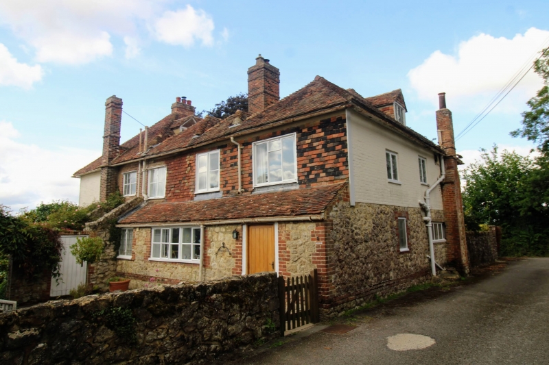
Entry Name: Stone Hill Farmhouse
Listing Date: 14 February 1967
Grade: II
Source: Historic England
Source ID: 1319954
English Heritage Legacy ID: 180864
ID on this website: 101319954
Location: Egerton, Ashford, Kent, TN27
County: Kent
District: Ashford
Civil Parish: Egerton
Traditional County: Kent
Lieutenancy Area (Ceremonial County): Kent
Tagged with: Farmhouse
1.
5272 EGERTON STONE HILL ROAD
Stone Hill Farmhouse
TQ 94 NW 10/20 14.2.67
II
2.
C18. Two storeys painted brick. Hipped tiled roof. Four casement windows
with small square leaded panes. Pentagonal porch.
Listing NGR: TQ9074046958
External links are from the relevant listing authority and, where applicable, Wikidata. Wikidata IDs may be related buildings as well as this specific building. If you want to add or update a link, you will need to do so by editing the Wikidata entry.


Other nearby listed buildings
