Approximate Location Map
Large Map »
Latitude: 51.1908 / 51°11'26"N
Longitude: 0.7284 / 0°43'42"E
OS Eastings: 590750
OS Northings: 147050
OS Grid: TQ907470
Mapcode National: GBR QTS.BZ2
Mapcode Global: VHKKC.KBYG
Plus Code: 9F325PRH+89
Entry Name: Barling's Manor
Listing Date: 10 October 1980
Grade: II
Source: Historic England
Source ID: 1362625
English Heritage Legacy ID: 180867
ID on this website: 101362625
Location: Egerton, Ashford, Kent, TN27
County: Kent
District: Ashford
Civil Parish: Egerton
Traditional County: Kent
Lieutenancy Area (Ceremonial County): Kent
Tagged with: Manor house
1.
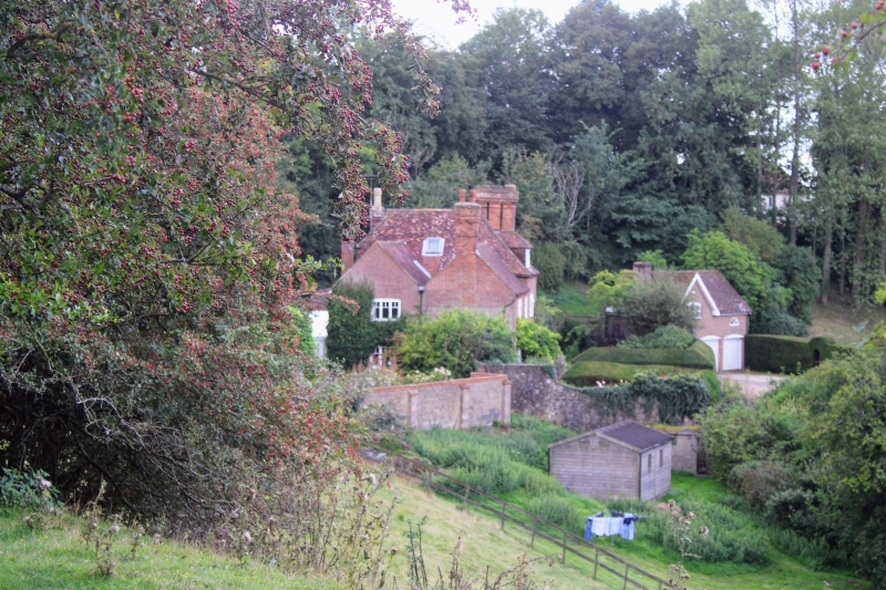
5272 EGERTON STONE HILL ROAD
Barling's Manor
TQ 94 NW 10/170
II
2.
C18 or earlier. Two to 3 storeys red brick. The right-hand side has a half-hipped
gable. Tiled rocf, with one dormer. Three casement windows. Later weather
porch.
Listing NGR: TQ9075047050
External links are from the relevant listing authority and, where applicable, Wikidata. Wikidata IDs may be related buildings as well as this specific building. If you want to add or update a link, you will need to do so by editing the Wikidata entry.


Other nearby listed buildings
