Approximate Location Map
Large Map »
Latitude: 51.195 / 51°11'41"N
Longitude: 0.7291 / 0°43'44"E
OS Eastings: 590782
OS Northings: 147515
OS Grid: TQ907475
Mapcode National: GBR QTS.54G
Mapcode Global: VHKKC.L798
Plus Code: 9F325PVH+XJ
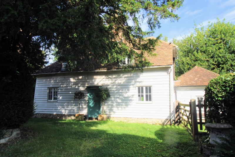
Entry Name: Glebe Cottage
Listing Date: 10 October 1980
Grade: II
Source: Historic England
Source ID: 1071495
English Heritage Legacy ID: 180879
ID on this website: 101071495
Location: Egerton, Ashford, Kent, TN27
County: Kent
District: Ashford
Civil Parish: Egerton
Traditional County: Kent
Lieutenancy Area (Ceremonial County): Kent
Tagged with: Cottage
1.
5272 EGERTON THE STREET
(north-west side)
Glebe Cottage
TQ 94 NW 10/165
II
2.
C18. L-shaped. One storey and attics weatherboarded. Hipped tiled roof
with 2 hipped dormers. Casement windows. Simple doorcase with flat wooden
weather hood on brackets. The rear wing is tile-hung.
Listing NGR: TQ9078147513
External links are from the relevant listing authority and, where applicable, Wikidata. Wikidata IDs may be related buildings as well as this specific building. If you want to add or update a link, you will need to do so by editing the Wikidata entry.


Other nearby listed buildings
