Approximate Location Map
Large Map »
Latitude: 51.1961 / 51°11'45"N
Longitude: 0.7318 / 0°43'54"E
OS Eastings: 590967
OS Northings: 147645
OS Grid: TQ909476
Mapcode National: GBR QTL.ZTG
Mapcode Global: VHKKC.M6RD
Plus Code: 9F325PWJ+CP
Entry Name: Range of Cartsheds 50 Yards to South East of Court Lodge
Listing Date: 10 October 1980
Grade: II
Source: Historic England
Source ID: 1071500
English Heritage Legacy ID: 180885
ID on this website: 101071500
Location: Egerton, Ashford, Kent, TN27
County: Kent
District: Ashford
Civil Parish: Egerton
Traditional County: Kent
Lieutenancy Area (Ceremonial County): Kent
Tagged with: Building
1.
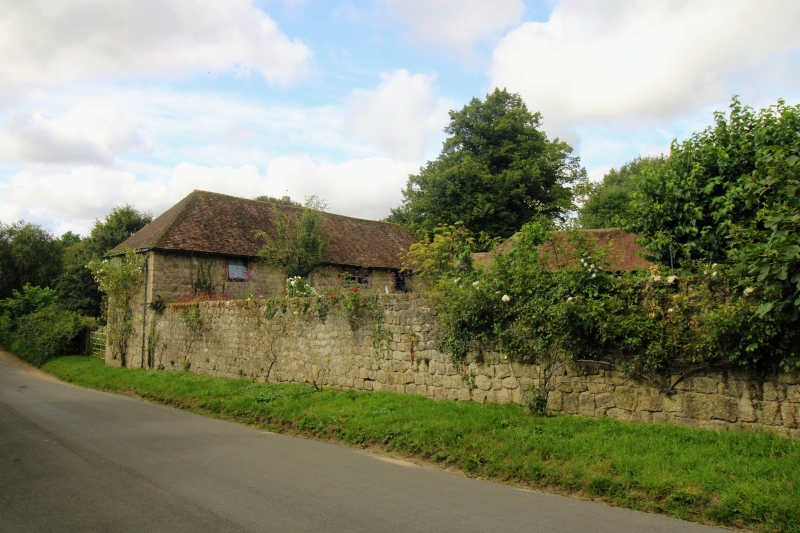
5272 EGERTON THE STREET
(south-west side)
Range of cartsheds
50 yds to south-east
of Court Lodge
TQ 94 NW 10/14C
II
2.
C18 L-shaped range of ragstone cartsheds with red brick dressings. Tiled roofs.
Listing NGR: TQ9097047708
External links are from the relevant listing authority and, where applicable, Wikidata. Wikidata IDs may be related buildings as well as this specific building. If you want to add or update a link, you will need to do so by editing the Wikidata entry.


Other nearby listed buildings
