Approximate Location Map
Large Map »
Latitude: 51.179 / 51°10'44"N
Longitude: 0.7537 / 0°45'13"E
OS Eastings: 592568
OS Northings: 145799
OS Grid: TQ925457
Mapcode National: GBR RWB.5C1
Mapcode Global: VHKKD.0MTK
Plus Code: 9F325QH3+HF
Entry Name: Munday Farmhouse
Listing Date: 10 October 1980
Grade: II
Source: Historic England
Source ID: 1071449
English Heritage Legacy ID: 181075
ID on this website: 101071449
Location: Pluckley, Ashford, Kent, TN27
County: Kent
District: Ashford
Civil Parish: Pluckley
Built-Up Area: Pluckley Thorne
Traditional County: Kent
Lieutenancy Area (Ceremonial County): Kent
Tagged with: Farmhouse
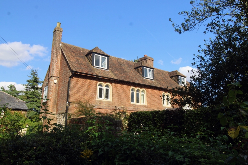
1.
5272 PLUCKLEY EGERTON ROAD
Munday Farmhouse
TQ 9245 27/51
II
2.
C18. Two storeys red brick. Roof with 3 hipped dormers. Four Dering windows. Later
porch.
Listing NGR: TQ9256845799
External links are from the relevant listing authority and, where applicable, Wikidata. Wikidata IDs may be related buildings as well as this specific building. If you want to add or update a link, you will need to do so by editing the Wikidata entry.


Other nearby listed buildings
