Approximate Location Map
Large Map »
Latitude: 51.1705 / 51°10'13"N
Longitude: 0.7264 / 0°43'34"E
OS Eastings: 590691
OS Northings: 144786
OS Grid: TQ906447
Mapcode National: GBR QTZ.JG2
Mapcode Global: VHKKC.JVV1
Plus Code: 9F325PCG+6G
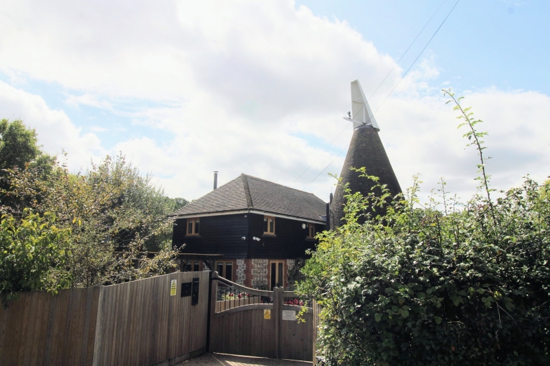
Entry Name: Giles Farm Oast
Listing Date: 10 October 1980
Grade: II
Source: Historic England
Source ID: 1087083
English Heritage Legacy ID: 181106
ID on this website: 101087083
Location: The Pinnock, Ashford, Kent, TN27
County: Kent
District: Ashford
Civil Parish: Pluckley
Traditional County: Kent
Lieutenancy Area (Ceremonial County): Kent
Tagged with: Drying house
This list entry was subject to a Minor Amendment on 18 September 2023 to update the name and address and to reformat the text to current standards
TQ 94 SW
14/21A
PLUCKLEY
THE PINNOCK
Giles Farm Oast
(Formerly listed as Oasthouse to west of Giles Farmhouse)
II
C19 cylindrical ragstone oast with conical roof, attached to a Kentish ragstone outbuilding which in turn is attached to an C18 weatherboarded barn, with half-hipped tiled roof.
Listing NGR: TQ9069144786
External links are from the relevant listing authority and, where applicable, Wikidata. Wikidata IDs may be related buildings as well as this specific building. If you want to add or update a link, you will need to do so by editing the Wikidata entry.


Other nearby listed buildings
