Approximate Location Map
Large Map »
Latitude: 51.1701 / 51°10'12"N
Longitude: 0.743 / 0°44'34"E
OS Eastings: 591858
OS Northings: 144787
OS Grid: TQ918447
Mapcode National: GBR RWB.GPW
Mapcode Global: VHKKC.TVNB
Plus Code: 9F325PCV+36
Entry Name: Thorne House
Listing Date: 10 October 1980
Grade: II
Source: Historic England
Source ID: 1086983
English Heritage Legacy ID: 181111
ID on this website: 101086983
Location: Pluckley Thorne, Ashford, Kent, TN27
County: Kent
District: Ashford
Civil Parish: Pluckley
Built-Up Area: Pluckley Thorne
Traditional County: Kent
Lieutenancy Area (Ceremonial County): Kent
Tagged with: House
1.
5272 PLUCKLEY SMARDEN ROAD
Pluckley Thorne
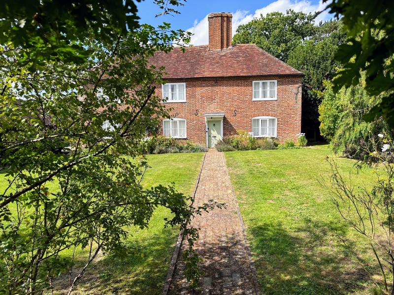
Thorne House
TQ 94 SW 14/126
II
2.
C18. Two storeys red brick. Hipped tiled roof. Eight casement windows.
Doorcase with flat hood on brackets.
Listing NGR: TQ9185844787
External links are from the relevant listing authority and, where applicable, Wikidata. Wikidata IDs may be related buildings as well as this specific building. If you want to add or update a link, you will need to do so by editing the Wikidata entry.


Other nearby listed buildings
