Approximate Location Map
Large Map »
Latitude: 51.175 / 51°10'30"N
Longitude: 0.7537 / 0°45'13"E
OS Eastings: 592582
OS Northings: 145357
OS Grid: TQ925453
Mapcode National: GBR RWB.CCC
Mapcode Global: VHKKD.0QSL
Plus Code: 9F325QG3+2F
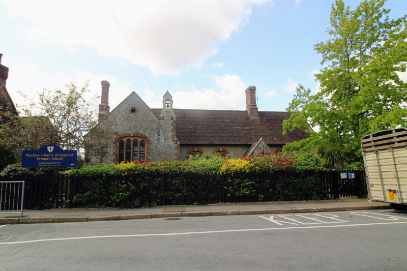
Entry Name: Pluckley Church of England Primary School
Listing Date: 10 October 1980
Grade: II
Source: Historic England
Source ID: 1071429
English Heritage Legacy ID: 181129
ID on this website: 101071429
Location: Pluckley, Ashford, Kent, TN27
County: Kent
District: Ashford
Civil Parish: Pluckley
Built-Up Area: Pluckley Thorne
Traditional County: Kent
Lieutenancy Area (Ceremonial County): Kent
Tagged with: Building
1.
5272 PLUCKLEY THE STREET
(south-west side)
Pluckley Church
of England Primary School
TQ 9245 27/43
II GV
2.
C19. One storey Kentish ragstone with red brick dressings. Fishscale tiled
roof with brick chimney stacks. Gable and bellcote to left-hand side. Five
Dering windows, set in red brick hood moulding with keystones. Gabled porch.
Listing NGR: TQ9258245357
External links are from the relevant listing authority and, where applicable, Wikidata. Wikidata IDs may be related buildings as well as this specific building. If you want to add or update a link, you will need to do so by editing the Wikidata entry.


Other nearby listed buildings
