Approximate Location Map
Large Map »
Latitude: 51.1435 / 51°8'36"N
Longitude: 0.6864 / 0°41'10"E
OS Eastings: 588006
OS Northings: 141680
OS Grid: TQ880416
Mapcode National: GBR QVB.6C7
Mapcode Global: VHJN2.VJ67
Plus Code: 9F324MVP+CG
Entry Name: Fleet Farmhouse
Listing Date: 14 February 1967
Grade: II
Source: Historic England
Source ID: 1071408
English Heritage Legacy ID: 181180
ID on this website: 101071408
Location: Smarden, Ashford, Kent, TN27
County: Kent
District: Ashford
Civil Parish: Smarden
Built-Up Area: Smarden
Traditional County: Kent
Lieutenancy Area (Ceremonial County): Kent
Tagged with: Farmhouse
1.
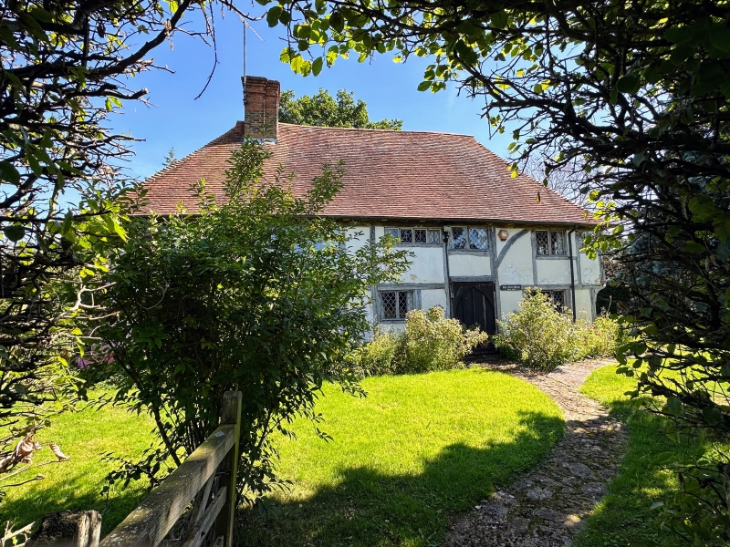
5272 SMARDEN BETHERSDEN ROAD
Fleet Farmhouse
TQ 84 SE 13/75 14.2.67.
II
2.
Probably a late mediaeval timber-framed building. Two storeys faced with weatherboarding.
Hipped tiled roof. Three casement windows.
Listing NGR: TQ8783541892
External links are from the relevant listing authority and, where applicable, Wikidata. Wikidata IDs may be related buildings as well as this specific building. If you want to add or update a link, you will need to do so by editing the Wikidata entry.


Other nearby listed buildings
