Approximate Location Map
Large Map »
Latitude: 51.1393 / 51°8'21"N
Longitude: 0.6883 / 0°41'17"E
OS Eastings: 588159
OS Northings: 141214
OS Grid: TQ881412
Mapcode National: GBR QVB.DVZ
Mapcode Global: VHJN2.WM7H
Plus Code: 9F324MQQ+P8
Entry Name: Luckhurst
Listing Date: 10 October 1980
Grade: II
Source: Historic England
Source ID: 1071375
English Heritage Legacy ID: 181191
ID on this website: 101071375
Location: Haffenden Quarter, Ashford, Kent, TN27
County: Kent
District: Ashford
Civil Parish: Smarden
Built-Up Area: Smarden
Traditional County: Kent
Lieutenancy Area (Ceremonial County): Kent
Tagged with: Building
1.
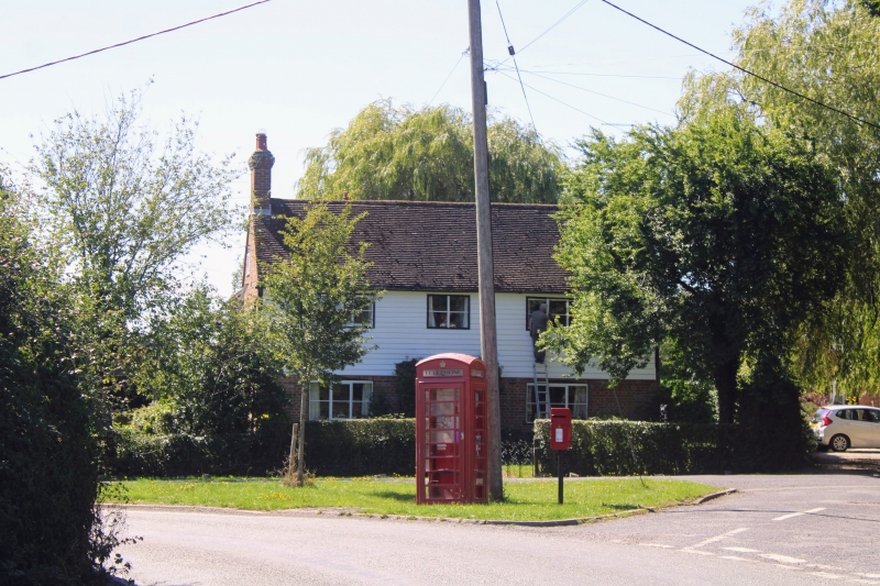
5272 SMARDEN BIDDENDEN ROAD
Haffenden Quarter
Luckhurst
TQ 84 SE 13/120
II
2.
C18. L-shaped. Two storeys. Ground floor red brick, first floor weatherboarded.
Tiled roof. Three casement windows. Doorcase has flat wooden weatherboard.
Listing NGR: TQ8815941214
External links are from the relevant listing authority and, where applicable, Wikidata. Wikidata IDs may be related buildings as well as this specific building. If you want to add or update a link, you will need to do so by editing the Wikidata entry.


Other nearby listed buildings
