Approximate Location Map
Large Map »
Latitude: 51.1464 / 51°8'47"N
Longitude: 0.6838 / 0°41'1"E
OS Eastings: 587817
OS Northings: 141996
OS Grid: TQ878419
Mapcode National: GBR QV9.5P5
Mapcode Global: VHJN2.SGW0
Plus Code: 9F324MWM+HG
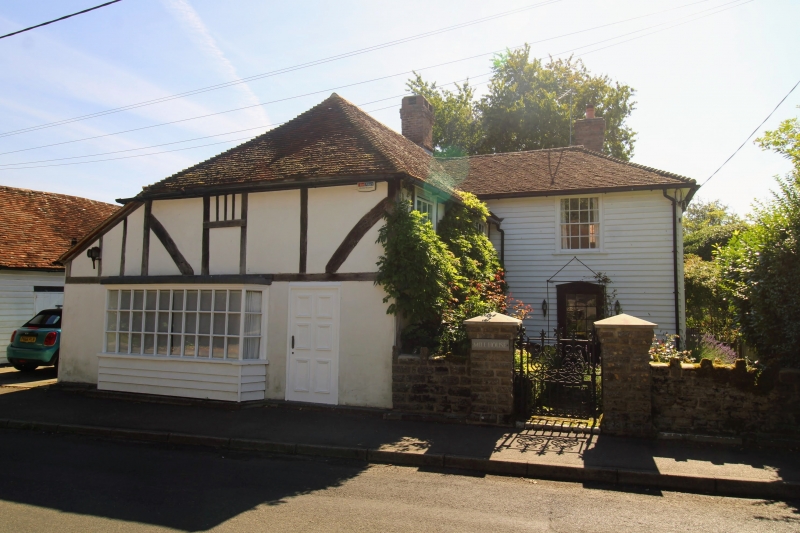
Entry Name: Mill House
Listing Date: 10 October 1980
Grade: II
Source: Historic England
Source ID: 1071377
English Heritage Legacy ID: 181199
ID on this website: 101071377
Location: Smarden, Ashford, Kent, TN27
County: Kent
District: Ashford
Civil Parish: Smarden
Built-Up Area: Smarden
Traditional County: Kent
Lieutenancy Area (Ceremonial County): Kent
Tagged with: House
1.
5272 SMARDEN CAGE LANE
Mill House
TQ 8742 23/21
TQ 8741 30/21
II
2.
C18 or earlier, 2 storeys faced with weatherboarding. Hipped tiled roof.
Four sashes with glazing bars intact. The north-west wing has an C18 shop
window complete with glazing bars.
Listing NGR: TQ8781741996
External links are from the relevant listing authority and, where applicable, Wikidata. Wikidata IDs may be related buildings as well as this specific building. If you want to add or update a link, you will need to do so by editing the Wikidata entry.


Other nearby listed buildings
