Approximate Location Map
Large Map »
Latitude: 51.1538 / 51°9'13"N
Longitude: 0.681 / 0°40'51"E
OS Eastings: 587589
OS Northings: 142808
OS Grid: TQ875428
Mapcode National: GBR QV3.QYP
Mapcode Global: VHJN2.R8CC
Plus Code: 9F325M3J+GC
Entry Name: Barn to South West of Ash Farmhouse
Listing Date: 10 October 1980
Grade: II
Source: Historic England
Source ID: 1071381
English Heritage Legacy ID: 181210
ID on this website: 101071381
Location: Smarden Bell, Ashford, Kent, TN27
County: Kent
District: Ashford
Civil Parish: Smarden
Traditional County: Kent
Lieutenancy Area (Ceremonial County): Kent
Tagged with: Barn
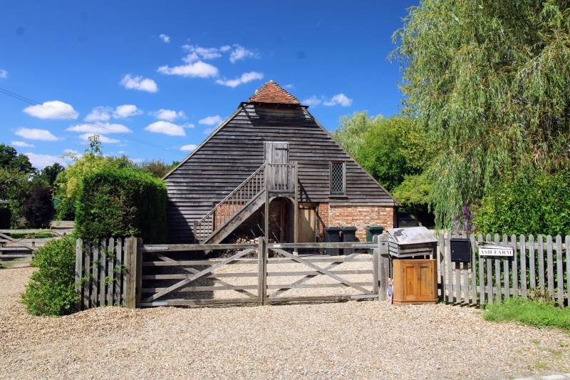
1.
5272 SMARDEN MILL LANE
Barn to south-west
of Ash Farmhouse
TQ 8742 23/28B
II
2.
C18. Two storeys. Ground floor red brick with grey headers. First floor
weatherboarded. Half-hipped tiled roof.
Listing NGR: TQ8758942808
External links are from the relevant listing authority and, where applicable, Wikidata. Wikidata IDs may be related buildings as well as this specific building. If you want to add or update a link, you will need to do so by editing the Wikidata entry.


Other nearby listed buildings
